One of the major initiatives of the Coalition is to identify potential abandoned mine land reclamation projects and to help secure funding for these projects through AML Pilot funds or other sources. This AML project map displays each funded or potential pilot project identified by RAC since the coalition’s creation, differentiated by state. Scroll around on the map and click on the dots to open a pop-up box with more information on each of these projects.
Map by Matt Hepler, Appalachian Voices
AML Projects List
VIRGINIA Projects2020 Projects
Southwest Virginia Recycling and ReUseAbout This Project
Until recent years, many Southwest Virginia counties operated popular recyclables collection programs through which citizens could reduce waste bound for landfills by recycling paper, cardboard, plastic, aluminum, steel cans, electronics, batteries, automobile tires, and white goods (stoves, refrigerators, etc.) at curbside and local convenience centers. These programs increased citizen involvement in solid waste management, conserved landfill space, and diverted trash from local streams and rivers in the Clinch-Powell (Upper Tennessee River) watershed, one of the most biodiverse headwaters regions in the nation.
However, these programs were shut down as so many local recycling programs have been across the country as markets for post-consumer recyclable materials have disappeared. Virginia’s solid waste regulations still mandate that municipalities recycle a portion of their waste streams, but for Southwest Virginia, those requirements are mostly being met through commercial recycling initiatives. Local governments in Southwest Virginia have formed an informal “Southwest Virginia Solid Waste Authority,” with leadership from Wise County, whose landfill operation currently costs the county between $2-$3 million annually. The Authority is seeking opportunities to find new markets for post-consumer materials.
Plastic Recycling
One opportunity for localities in Southwest Virginia to divert plastic waste from landfills and save money on landfilling is to sell post-consumer plastic to a plastics recycling company in nearby Eastern Tennessee. However, the purchasing company requires the plastic to be processed into smaller pieces prior to its sale, using a commercial plastic chipper. Such an investment is not worthwhile for a small locality that doesn’t create enough plastic waste to interest the purchasing company, but a collaboration of localities in the region could purchase a larger chipper and aggregate their plastic waste, creating enough product to be able to sell it to the recycling company. Such an investment would likely cost between $200,000-$300,000, depending on the size. The Wise County landfill is located on a former coal mine, and numerous AML-Pilot eligible sites exist across the region that could house such a facility.
Digesters and Composting
Nearby localities in Eastern Tennessee have inspired local officials in Southwest Virginia with large digesters used to break down a large portion of their waste stream into compost. Southwest Virginia communities could share the costs of these facilities to reduce the amount of waste that goes into their landfills, while creating a compost product compost that can be used as an additional revenue generator for the localities, and possible in coal-mined land soil remediation. With collaboration from local colleges, such a facility could also serve as an educational tool for students studying soil sciences and land restoration, and provide compost to local farmers and gardeners, and for soil remediation of coal-mined land in reclamation projects.
Additional ReUse Opportunities
As the Southwest Virginia Solid Waste Authority takes shape, additional opportunities may arise for collaborations with the Coalfield Development Corporations ReUse Corridor, which is a multi-state upcycling coalition in central Appalachia using US-23 as its backbone. The Authority can provide a structure for Southwest Virginia companies and localities to find new buyers for their waste products and new sources of materials for companies that recycle or upcycle.
Partnerships
Due to the need to aggregate waste in order to have enough product for sale, collaboration from all of the local governments in Southwest Virginia is critical to project success. Additional partners could include the ReUse Corridor and Coalfield Development Corporation, the Wise County Extension Office Master Gardeners program, Wise County/Keep Wise County Beautiful and other similar county initiatives, the Lonesome Pine Soil and Water Conservation District, Mountain Empire Community College, Southwest Community College, and the University of Virginia College at Wise.
AML Nexus
The Wise County landfill is located on a reclaimed coal mine, and may be a good site for a digester or chipper facility. Additionally, numerous other AML-Pilot sites near US-23 would also be possible for new recycling centers, providing easy access to the freeway for transporting materials across Southwest Virginia and Central Appalachia. Lastly, composted material can be used for soil remediation on previously-mined sites, especially as more of this land is considered for eventual agricultural use.
Project Impact
The most immediate impact for this project would be cost-savings for localities that save money on landfilling their solid waste. Landfills are a significant portion of a local government’s budget. Composted materials produced by the localities could also be used as a revenue generator for local governments. Having recycling and reuse infrastructure in place in the region also presents an opportunity for entrepreneurs to find new uses for post-consumer materials, especially if Southwest Virginia connects with the partners in the ReUse Corridor, expanding the network of potential source materials and potential buyers for post-consumer materials.
About this Project
Farmland in Appalachia has declined in recent decades, with the Appalachian Regional Commission reporting that nearly all Appalachian counties and subregions saw a reduction in the total number of farmland acres between 2007 and 2012. The region lost 858,858 acres during this time. However, agriculture presents a significant economic opportunity in Virginia. According to the Virginia Department of Agriculture and Consumer Services, agriculture is Virginia’s largest private industry, with an annual economic impact of $70 billion generated and more than 334,000 jobs supported. Every job in agriculture and forestry supports 1.7 jobs elsewhere in Virginia’s economy.
The most recent Agriculture Census identified 2,411 farms in the LENOWISCO Planning District Commission (PDC) region, which includes Wise, Lee, and Scott counties — down from 2,643 in 1997. The LENOWISCO PDC published a Regional Agricultural Development Strategic Plan in 2017 that detailed recommendations for supporting regional agricultural development and to leverage the area’s agricultural and forestry assets to advance economic development, including recommendations to:
Enhance support for existing farmers and agriculture-related enterprises,
Develop incubation activities for beginning or transitioning farmers;
Introduce youth to agriculture-related opportunities;
Nurture a regional culture of “agri-preneurship,” by providing mentoring, training, funding and related ecosystem support systems.
Agricultural industry workers and proponents have identified two projects that would advance agricultural and forest economic development in the region and help agricultural related businesses adapt to the unique coal-impacted landscape in Southwest Virginia.
Wise County Extension Learning Center
The Virginia Cooperative Extension is an educational outreach program of Virginia Tech and Virginia State University and part of the National Institute for Food and Agriculture. A network of universities, county and city offices, and research and education centers delivers various programs across the Commonwealth, including the Wise County extension office. The Wise County office is in need of a new facility to support its educational programs to farmers, gardeners, and ranchers in the region, as the current office does not have larger meeting room space, volunteer workspace, or a commercial kitchen. Siting the new facility on an abandoned coal mine site will allow the programs to incorporate the challenges associated with agriculture and forestry in the coalfield region.
The Extension Learning Center will include five offices, a reception area, a large meeting space for public educational programs, a volunteer workspace for programs such as the Master Naturalist or Master Gardeners, and a commercial kitchen set up for instruction and demonstration for cooking and canning classes. The kitchen could also provide space for new, small food-based businesses to process foods that require a commercial kitchen when the businesses are in development stage. The facility would also include two to five dorm rooms for hosting visiting specialists or professors. A comparable facility in Greeneville, Tennessee is approximately 3,900 square feet and cost approximately $900,000 for initial construction.
The outdoor grounds include two and three acres to be used for community gardening, livestock, pollinator habitat demonstration, beekeeping, invasive species control demonstration, native warm-season grass demonstration, crop demonstrations, and plant variety trials.
The new facility will allow the Extension to better serve more local farmers and support a growing agricultural economy in the region. Solar, wind, geothermal, and energy efficiency technologies will be incorporated where possible to grow farmer familiarity with these important technologies and to ensure the facility operations are as low-cost and sustainable as possible.
Wise County Schools Agricultural Programs
New agricultural courses offered by Wise County Schools would support the growth of a new generation of farmers in the region. Offering a new “career cluster” of courses for Wise County students will also allow the school system to create a new Future Farmers of America (FFA) chapter, allowing students to access numerous agricultural and leadership resources, grants, conferences, and other events, growing their learning and job opportunities.
New agricultural educational programs will require the construction of a facility that can house student programs. A comparable facility in Rural Retreat, Virginia is 10,000 square feet and cost $1.77 million. Such a facility would include a workshop, classroom space, hoop houses for crops, livestock working rooms, and land for crops. The agricultural program will require a new teacher for the new courses, providing at least one new job. Training a new generation of farmers, foresters, and other agricultural professionals will prepare young people for jobs in a growing industry, and also provide the training necessary for young people to help grow the agricultural industry locally, making food production more sustainable and keeping money in the local communities.
Partnerships
Numerous partners will boost the success of these important agricultural programs, including the Wise County Extension 4-H, Virginia Farm Bureau, FFA, Appalachian Sustainable Development, and local farmers will all be important to help with outreach to expand the reach of the programs provided by both facilities, and to boost the educational offerings provided. FFA programs in nearby Dickenson County, Russell County and Lee County will also be important partners to learn from their experiences and to connect student programs.
AML Nexus
There are numerous AML sites throughout Wise County that could be used for either or both projects. Both facilities’ programs will benefit from being sited on coal-impacted land in order to highlight the unique challenges and solutions associated with agriculture and forestry in Southwest Virginia, such as invasive species management, and to conduct variety trials for berries, vegetables, and ornamentals on mined land. Additionally, roughly 3,000 acres of reclaimed land is currently being used for livestock forage production in Wise County, but many ranchers typically use fescue for feed; an AML-sited facility would facilitate demonstrations of more productive and native grasses for local ranchers. Initial assessments found at least 13 AML-Pilot-eligible sites throughout Wise County that could be considered for both the extension office and the school facilities.
Project Impact
The preliminary construction cost estimate for the two facilities is $2.67 million, excluding any potential reclamation costs. Economic modeling illustrates that construction of the facilities would support nearly $6.3 million in regional economic activity, support nearly 50 jobs during construction, and provide over $2.2 million in wages to employees. The construction is expected to improve regional GDP by over $3.5 million. At least one teacher position would also be created as part of the school agriculture program. Local farmers, beekeepers, ranchers, and others in the farming industry will benefit from additional resources provided by the new learning center and new, young people entering the industry and helping to continue the operation of farms as older farmers retire. Local community members will see health benefits from the increase in availability of more local, fresh produce and the ability to grow their own food.
Funding Sources
Numerous potential funding sources exist for both facilities and programs. The USDA offers numerous community facilities, community food project, and rural development grants; FFA grants can support school programs, and the Virginia Tobacco Region Revitalization Commission funds investments in the region’s agribusiness economy. Additional funding may be available from the Virginia Department of Agriculture and Consumer Services or the Virginia Department of Education.
About this project
Southwest Virginia has a wealth of natural beauty, and the recreation economy in the region centers on outdoor options including hiking, biking trails, all-terrain vehicles, kayaking, canoeing, and fishing. However, these options are less attractive during the colder months of the year, and indoor recreation opportunities for sports such as basketball, volleyball, soccer, tennis, swimming, or rock climbing in Southwest Virginia are less abundant. Providing plentiful recreation options year-round is vital to attracting new residents to the region and is important for the health of existing residents, especially in an area where adults have a higher obesity rate and a higher death rate from cardiovascular disease, compared to state averages, according to CDC data.
Currently, community members rely on accommodating public school officials for access to maintained indoor facilities or private gyms for weightlifting and cardiovascular exercise equipment. Schools that allow public access to their sports facilities carry the burden of additional wear and tear on equipment and operation costs. These facilities are often inconsistently available and are only available to select groups in the community. A new, public indoor recreation center would be a significant step in making recreation in these counties accessible to more people and throughout the entire year. Such a facility would be maintained by the local governments or by a not-for-profit entity.
A publicly-accessible indoor recreation center would increase access to maintained courts, sports equipment, and safety instruction. Investments to create space for indoor sports recreation would benefit regional health, increase business for local businesses selling sports equipment, provide job opportunities, and act as a hub for community events.
The facility can also support the outdoor recreation economy by providing indoor training and education facilities for bouldering, rock climbing, biking, and others. Instructors at the facility can provide safety and how-to instruction to better prepare people for outdoor attractions across the region, mitigating injuries and hazards that are present in any recreation-based economy.
With a total estimated cost of $604,100, the project would result in total local economic activity valued at over $1.42 million. This project has the potential to support 10.5 construction jobs and employee earnings of $488,832 while improving regional GDP by close to $779,654.
Recreation facilities have also been linked to a variety of health benefits for their surrounding communities. Access to exercise facilities helps to prevent heart disease and type 2 diabetes, controlling blood pressure, cholesterol, obesity, and can reduce stress and the likelihood of depression. The facility would contribute to a better quality of life for the surrounding community, while having the potential to spark new community-building and economic opportunities.
Partnerships
Potential partnerships for this project include the local governments where the facility is located to maintain the facility and provide staffing. Initial efforts are focused in Norton, where the City of Norton and Wise County are potential partners for this project. As both localities focus on recreation as a piece of the region’s appeal to visitors and residents, an indoor recreation center that promotes outdoor recreation during colder parts of the year would be a uniquely beneficial opportunity for the region. Other potential partnerships include the Wise County Health Department, Ballad Health, and UVA-Wise. Where community health and well-being is concerned, a recreation facility provides a multitude of health benifits for all ages in the communities. Partnerships with local schools and colleges could provide a user base by providing passes for students. This would provide additional health benefits and accessible facilities for students and faculty when on-campus facilities are restricted.
AML Nexus
There are numerous AML sites throughout Southwest Virginia that could be repurposed for a recreation facility after reclamation is completed. One possible site considered for the facility is in Norton, located adjacent to Project Intersection, a multi-million dollar project that involves the reclamation of a large high wall and preparation of the site for new industrial activity.
Funding Sources
Numerous private foundations support healthy lifestyles and access to physical fitness activities, especially in disadvantaged communities. Project developers could pursue funding from following foundations and organizations: W.K. Kellogg Foundation, Wells Fargo, Ballad Health, AARP Foundation, and the Annie E. Casey Foundation, among others.
About this project
Pound, Virginia is the oldest town in Wise County and stretches for two miles alongside the Pound River. The small town of less than 1,000 residents has been on the front lines of coal’s decline both in terms of budget losses and in terms of reclamation need, as a significant portion of the town’s acreage outside of the downtown area has been affected by coal mining.
One immediate need facing the town is the mitigation of a dangerous landslide in the downtown area, with the traffic on US-23 Business/Main Street running through the middle of town under threat from the landslide. The road above the landslide provides access to a church and homes, and is crumbling away at the edge. Below the landslide, an abandoned building and underground gas tanks need to be removed.
Community members developed a plan for the downtown in 2007, envisioning a Pound Riverwork with revitalized sidewalks, crosswalks, lighting, bridges across the Pound River, and a new town square. The project aims to remove the immediate safety risk of the landslide on residents and traffic through the community, improve walkability for both residents and visitors, increase traffic to downtown businesses, improve access to the river for recreation, and create a space for events or casual gatherings.
Partnerships
Opportunity SWVA, the Historical Society of Pound, and Appalshop have facilitated many of the community discussions around the vision for the downtown space. The Historical Society and the Pound Lions Club are both important partners for fundraising and supporting small projects such as benches and signage. The Virginia Tech Community Design Assistance Center will help to update the initial design developed in 2007. Spearhead Trails has developed some of the river access points; continued coordination with Spearhead Trails will ensure connectivity and optimal access for the outdoor spaces.
AML Nexus
An inspection conducted by the Department of Mines, Minerals, and Energy concluded that despite the fact that the landslide is located adjacent to a coal mine permit area, the landslide is not caused by the coal mining, and thus is not eligible for AML Pilot funding. However, roughly 20% of the land area in Pound has been mined, leaving the town with significant reclamation needs. As the Riverwalk and other infrastructure is expanded throughout the community, it is likely that the infrastructure will be near other AML features eligible for Pilot funding.
Funding Sources
Virginia Brownfields funding will be essential for stabilizing the landslide and removing underground gas tanks. Though the landslide itself is not eligible for AML Pilot funding, AML Pilot funding may be used for future phases of the project as it expands into other parts of the town. Additionally, community development and downtown revitalization funding from the Virginia Department of Housing and Community Development could be used to support the project. Funding from the Virginia Outdoors Foundation, the Virginia Department of Game and Inland Fisheries, or the Virginia Department of Conservation and Recreation could support trail or river access development in future phases. The Virginia Tech Community Design Assistance Center is providing in-kind support through their design assistance.
Project Impact
Most urgently, the project will remediate the landslide which, if not stabilized soon, will result in the loss of road access to homes and a church, block traffic in the center of town, and possibly cause injury or even death to people near the landslide when it collapses further. Beyond this immediate need, the project will create infrastructure for use by the community members and visitors, and serve businesses by improving access for downtown stores. Increased access to businesses will also improve the town’s ability to attract new businesses to the downtown area. These improvements will result in increased tax revenue for the town and county. The project would also attract more visitors to the town to utilize the riverwalk and river access points and allow them to visit the stores more safely. Economic modeling of the project suggests project spending will result in a total economic output of nearly $2 million, nearly $700,000 in employee earnings, and a total of 15 jobs on- and off-site.
About this Project
The community of Dante, Virginia, the former headquarters of Clinchfield Coal Corporation, received $269,000 in funding as part of the DMME’s 2018 AML Pilot program after revising their 2017 application to reflect the updated needs and vision of the community. Now, the community leaders of the Dante Community Association (DCA) are preparing to submit a Phase 2 application for the coming round of Virginia AML Pilot funding.
The funded Phase 1 project features a series of ATV, biking, and walking trails and the reclamation of two abandoned mine portals in the community. Additionally, the Virginia Department of Environmental Quality awarded a $215,000 brownfields assistance grant for the redevelopment at the Arty Lee School site, an important part of the Dante community’s Black history.
Phase 2 will include the development of mountain bike trails within the Laurel Branch Watershed that will connect to the existing trail system. Additionally, an old steam building will be converted into office space and a work training center run by Southwest Virginia Workforce Development, and new fiber optic cable infrastructure will be developed.
The Nature Conservancy, as part of the Cumberland Forest Project, now owns the land on which the mountain bike trails are proposed to be developed. The mountain bike trail routes may utilize existing mining and logging roads . If used, these roadbeds need drainage work and other improvements in order to convert them into sustainable mountain biking trails capable of handling increased and prolonged usage.
The site of the steam plant is owned by the construction company B. Williams Resources and is adjacent to a parcel currently owned by Contura Energy. Both sites will be donated to the Dante Community Association for the purposes of this revitalization project. The Southwest Virginia Workforce Development Board is interested in developing programming at the steam plant site after redevelopment, including adult education courses, General Educational Development (GED) and National Career Readiness Certificate (NCRC) testing, and potential for the site as a Pearson Vue testing center. The Board has also secured licensing for LinkedIn virtual learning opportunities and is expecting access to 180 Skills, which will both be made available to participants at the proposed center.
AML Nexus
The steam building site is located adjacent to the previous Dante Lick Creek Watershed Project, a stream restoration project which remediated issues of clogged stream land. This past AML project serves as the nexus between previously remediated AML features and the existing steam building.
The proposed trail system is close to multiple open mine portals, which are partially collapsed and pose potential risks. The mine portals are currently Priority 3 sites, however, they would become Priority 2 sites if the trail system is expanded to be in closer proximity to them. Some of the open mine portals have partially reclaimed themselves, meaning that the portals have collapsed or otherwise closed to a point that they no longer pose significant danger.
The proposed trails will also intersect an existing trail system that was previously constructed using AML Pilot Program funding. Additionally, the proposed trailhead is located at the previous Arty Lee School site, at which gob pile removal processes occurred.
Partnerships
Given their recently acquired land in Dante, The Nature Conservancy is a key partner in developing and maintaining new trails. Virginia Tech’s Community Design Assistance Center continues to play a role in implementing and updating their original designs for the community. The Southwest Virginia Workforce Development Board, the Cumberland Plateau Planning District, Virginia Coalfield Economic Development Authority (VCEDA), GO Virginia, and Dickenson and Russell Counties will be important partners in ensuring the success of the office space and training center, connecting employers and workers with the new facility. Applied Trail Research, Spearhead Trails, and Appalachian Conservation Corps are important partners for maintaining existing trails and building new trails. Local outdoor recreation vendors will be important partners for promoting the new trails and providing equipment for their safe use.
Funding Sources
In addition to AML Pilot funding, other potential sources of funding for new trails include the Virginia Outdoors Foundation or the Virginia Department of Conservation and Recreation. For the steam building and fiber optic cable, additional funding could come from Appalachian Regional Commission, GO Virginia, Department of Housing and Community Development, the VCEDA, or the Virginia Department of Game and Inland Fisheries.
2019 Projects
Symply Data CentersAbout This Project
Symply Data Centers, launched in 2017, offers services to allow anyone the opportunity to mine cryptocurrencies. Cryptocurrency is a tradable, digital form of money built on what is known as blockchain technology, which only exists online. Symply Data Centers purchases, builds, and maintains its customers’ mining rigs—the computer systems used for mining bitcoins—in its data centers and also hosts corporate blockchain applications. The company opened its first data center in Piney Flats, Tennessee, in 2018 and is seeking funders for new locations across the country, particularly in Opportunity Zones, which allow investors to take advantage of tax benefits available for investments in economically-distressed communities.

Data centers use a considerable amount of electricity, with energy bills being one of Symply Data Centers’ most significant costs of operation. Additionally, data centers generate considerable excess heat. Symply Data Centers plans to reduce its overhead costs and thus the costs to its customers by powering its facilities with solar and, rather than venting the excess heat into the air, using it for on-site greenhouses, which will produce crops for an additional revenue stream.
The company is seeking $5 million in investments for the development of its next data center, which will include a 1-megawatt solar installation, an electrical building to supply the data center and house backup batteries and generators, up to four commercial greenhouses, and a data center building with hot-air ventilation to the nearby greenhouses. Symply Data Centers is specifically targeting areas such as abandoned mine lands (AML) and landfills to revitalize these “undesirable” sites for productive economic use. The construction of the facility will cost $4M, while the remaining $1M will fund employee salaries during the initial launch phase of the facility.
Partnerships
Symply Data Centers has been meeting with local government officials in Virginia to determine a possible AML site for its next data center. Hundreds of closed underground mines are being considered for the research. GO Virginia is also funding an effort that is seeking to pair mine sites with data centers, with the idea that cold water in mine pools could be used to help cool data centers. The University of Virginia College at Wise, Mountain Empire Community College, and the local county extension offices are all potential partners.
AML Nexus
Symply Data Centers is seeking sites with at least five acres of land in Opportunity Zones with suitable slope and sun exposure. There are a number of promising pre-SMCRA sites that meet these criteria in Virginia, particularly in Wise County. Features located on these sites include clogged streams, open mine portals, highwalls, dangerous impoundments, hazardous water bodies, and hazardous equipment and facilities.
One specific option that meets the data center’s basic requirements is Project Intersection in Norton, Va., which has been developed to attract new manufacturing and industrial operations to the coalfields. In 2018, the area received $3.5M in AML Pilot funding as well as $917,315 in Appalachian Regional Commission funding for highwall removal, road access, water and wastewater infrastructure, access to power, natural gas, and broadband service.
Another option includes land owned by the Wise County Industrial Development Authority near the Lonesome Pine Airport. Many AML features on this site have already been reclaimed, but a number of features remain, including hazardous equipment, highwalls, and hazardous water bodies.
Funding Sources
The project developers are primarily seeking funding from AML Pilot grants and Opportunity Zone investors. Additional funding from the Virginia Tobacco Region Revitalization Commission, the U.S. Small Business Administration, GO Virginia, and brownfields grant programs may be appropriate.
Project Impact
Construction of the site will cost $4M. The project will also further exemplify the potential of siting data centers in Southwest Virginia and demonstrate the benefits of solar energy in combination with such facilities. This will help to advance local efforts of the Solar Workgroup of Southwest Virginia to bring solar energy development jobs to the region.
The AMLIS database lists a number of AML features that could be reclaimed as part of this project if the project were to be installed at the Lonesome Pine Airport, including:
- Hazardous equipment or facilities: $1,000
- Highwalls: $1.04 million
- Hazardous water bodies: $20,000
Economic modeling of these potential project development costs ($5.06M) suggests that the construction of the data center would result in a total economic output of $11.4 million. Additionally, the project would provide nearly $4 million in earnings to employees across the region, support 84 full- and part-time jobs in different sectors of the economy, and provide nearly $6.5 million in value-added benefits. Long-term, developing a new data center in Virginia will provide approximately 25 jobs on-site—10 engineers and programmers at the data center, and up to 15 employees at the greenhouse.
Clinch River Waterfalls and Campgrounds About This Project The Clinch River is a focal point for environmental and wildlife conservation as well as economic diversification in Southwest Virginia. The river is an ecological hotspot, showcasing a large variety of mussels, fish, and amphibian species that rely on healthy water quality throughout its 300-mile path to the Tennessee River. Its waters attract tourists and outdoor enthusiasts from nearby states, offering scenic views, exceptional fishing, and boating opportunities ranging from family-friendly floats to mid-level whitewater excursions. In Southwest Virginia, the Clinch River plays an important role in economic diversification efforts within the region, as it is integral to local businesses such as the Clinch Life Outfitters and Pathfinders Outdoors Adventures. The Clinch River Valley Initiative (CRVI) is a collaborative effort in Southwest Virginia working with local partners to develop plans for connecting downtown revitalization, outdoor recreation, water quality, entrepreneurship, and environmental education along the river. A primary goal (and recent success) of this dedicated, grassroots effort is to develop the new Clinch River State Park in Virginia, incorporating numerous sites along the river. The Clinch River Campgrounds project seeks to preserve and enhance the Clinch River by using AML Pilot funds to reclaim AML features along its route, creating campgrounds accessible by boaters and hikers exploring the waterway and its picturesque waterfalls. These paddle-in campgrounds are a special commodity for adventure watersports enthusiasts and would create new opportunities for multi-day journeys along the river, increasing the economic benefits to riverside communities. For the 2019 Virginia AML Pilot funding, project partners will seek funds to purchase land along the river for AML feature remediation and for recreational structures such as new non-motorized trails to the river and other points of interest. The property will eventually be sold or donated to the Virginia Department of Conservation and Recreation for the new Clinch River State Park. Additional potential campground sites along the Clinch River have been identified and may be included in future AML Pilot applications. Partnerships Partners for the project include The Nature Conservancy, Virginia State Parks, and the Clinch River Valley Initiative. Additional partners for the development of future sites include Friends of Southwest Virginia, the Virginia Tourism Commission, UVa Wise and its Oxbow Center, the Virginia Department of Conservation and Recreation, The Virginia Department of Forestry, Southwest Virginia Community College, and the Heart of Appalachia Tourism Authority. AML Nexus The Nature Conservancy intends to purchase land near the river with historic mining features that likely qualify for AML Pilot funding that is also adjacent to land owned by CF Highlands LLC and managed by The Nature Conservancy; The CF Highlands LLC property has several P3 sites, including a spoil area estimated at $30,000 and an unreclaimed high wall estimated to cost $2 million. Funding Sources Additional funding support for land purchases and campground and trail development for the Clinch River State Park may come from state appropriations, private trail development and conservation funds such as the American Hiking Society’s National Trail Fund or the Conservation Alliance, Federal Recreational Trails Program Grants administered through the Virginia Department of Conservation and Recreation’s Recreational Trails Program, the Virginia Land Conservation Foundation (also administered by the Department of Conservation and Recreation), and Land and Water Conservation Fund grants. Project Impact Trail and campsite development costs could total $150,000, depending on the trail’s path and the facilities included for the campground. Reclamation of unfunded AML features near the site could cost more than $2.06 million, and there are numerous AML features located along and near the Clinch River that may need to be reclaimed as part of the development of the state park and the trails and campgrounds it will encompass. Economic modeling of these and other potential project development costs ($2.46 million) suggest that during its development, this project would result in a total economic output of $5.3 million, provide over $1.3 million in earnings to employees, support 31 regional full- and part-time jobs, and provide value-added benefits ($2.77 million). An economic impact analysis of the Clinch River State Park completed in 2013 estimated that the park would attract 106,400 annual visitors by its fifth year of existence. During the five-year construction and development of the Park (Phase 1), it is expected to bring in an annual economic impact of $3.58 million and 31 local jobs. This initial phase will cost $4.07 million. Later phases of the park development are expected to sustain 14 local jobs during construction phases and $1.95 million in economic impact. Beyond the economic impact of construction, the park is estimated to generate an annual economic impact of $2.53 million and sustain 23 jobs. Counties will benefit from an increase in tax revenue of $22,000 annually. This economic impact was based on the development of a 700-acre hub property, but the plan for the Park includes multiple access points serving as satellite properties along the river. The additional access points and trails along the river contemplated here will increase the economic impact of the park. Qualitatively, preservation and protection of the Clinch River is important for biodiversity, education, and health and quality of life improvements for local communities. Development of additional trails and campsites contributes to these impacts.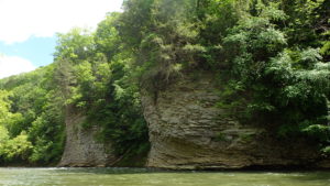

Appalachian Mountain Metro The coalfields of Southwest Virginia have a long, celebrated history of railroads. The vast web of rails connecting coal towns and cities were critical in the coal-based economy. However, like many industries relying on the declining coal economy, the railways have also seen less cars on their tracks. This project would repurpose the existing, underused freight rail infrastructure for passenger rail, enabling the connection between multiple coalfield communities throughout Southwest Virginia and beyond. Passenger rail service provided in eastern parts of the Commonwealth has been key to making Virginia economically competitive and an attractive tourist destination. Virginia utilizes an Intercity Passenger Rail Operating and Capital Fund which provides dedicated funds to support passenger rail service that provides $190 million in annual benefits to Virginia. However, passenger rail services currently ends in Roanoke, not connecting to the far southwestern counties of Virginia. Though it may also be possible to expand the existing rail lines to be used as both freight and passenger lines, it is unlikely that the railroad companies will want to take on the additional liability associated with using their lines for passenger transportation. The most promising opportunity to bring passenger rail to Southwest Virginia is to convert the lines to passenger rail when the current companies are ready to sell. It is expected that as the coal industry declines, railroad companies will begin to off-load assets within the next five years in Southwest Virginia and beyond, streamlining their services to key routes across the country. The opportunity to purchase and convert these lines to passenger rail will present itself quickly; interested companies and agencies should start to envision the possibilities and make a plan for action now. Because these railroads largely stretch across coalfields, they are often surrounded by a variety of AML features. For example, the Clinchfield Railroad has ample opportunities for reclamation, with AML features such as highwalls, hazardous equipment and facilities, and gob piles. Several railways across the region exhibit similar potential for AML Pilot funding. Utilizing estimations developed through the study of completed freight to passenger rail line conversions in the U.S., the project team expects this project to cost in the ballpark of $1.5 billion. This would include the purchase and conversion of 150 miles of rail line, the purchase of locomotives and passenger cars, and the construction of 8 stations outfitted with ticket-vending machines. The many paths and connections the rails cover make it a potential vehicle for the interconnection of rural Appalachia to nearby urban centers, which may rejuvenate the rail routes and the communities they traverse. Easy access in and out of rural America has the potential to easily transport Southwest Virginians to jobs and recreational activities outside of their region; allow people to keep jobs in other regions but move to Southwest Virginia to take advantage of inexpensive housing and a rural lifestyle; and allow people living outside of the region to more easily access Southwest Virginia’s many recreational and cultural assets.
Cumberland Forest AML Solar Project About This Project The Nature Conservancy and its local partners are working to build upon Appalachia’s legacy as a domestic energy provider by capitalizing on the vast amount of land available from former surface coal mines and using it for siting a new form of clean energy development. Preliminary analysis conducted by The Nature Conservancy and Downstream Strategies suggests that across central Appalachia, there are up to 400,000 acres of former minelands that could meet the minimum site suitability requirements for large-scale, ground mounted solar power installations—meaning the land is relatively flat and lacking forest cover and has preexisting access roads and necessary transmission lines. If all of this land area were harnessed for solar development, it could double the total solar capacity that has been installed in the United States so far. Partnerships A variety of stakeholders would benefit from advancing this market opportunity and could all play important roles in facilitating solar development in Appalachia. They include local, regional, and state government entities, mineland owners, mining companies, electric utilities, solar installers and developers, large electricity consumers such as data centers and manufacturing companies, nonprofit organizations, and local solar energy advocates. These stakeholders could be involved in advancing specific projects or broad policies. An alliance of diverse stakeholders working together would make it possible for more solar development to occur at a faster pace. Many local and regional organizations are ready to advance these goals of solar energy development, including the Solar Workgroup of Southwest Virginia, Mountain Association of Community Economic Development, and many others. The Nature Conservancy’s recent land purchase of more than 250,000 acres in the Central Appalachian Coalfields of Kentucky, Tennessee, and Virginia may present new opportunities for these existing efforts to have exciting breakthroughs with an expanding network of partners. Recently, Appalachian Voices has partnered with Antares Group, Inc., a renewable energy consulting and development company, to submit an application for Virginia’s 2019 AML Pilot program to develop up to five sites in southwestern Virginia for utility-scale solar projects. If the project is funded, former mined lands within The Nature Conservancy’s Cumberland Forest property will be prioritized as potential areas for this solar development. AML Nexus The Nature Conservancy recently purchased nearly 400 square miles of land in Central Appalachia. Embedded within these holdings are thousands of acres of former mined lands, including AML features and more recently reclaimed areas that remain in a non-forested condition. Solar development on these lands could provide opportunities for remediation of many of these features and make former minelands ecologically and economically productive once again. Funding Sources Public utilities, businesses, and private investors are already making investments in solar across Appalachia today. While the opportunity exists to focus some federal funding in the form of traditional AML, AML Pilot, and EPA Brownfields funds for the reuse of these sites as solar mines, the projects also have the potential to leverage billions of dollars in private investment and that can utilize tax benefits such as the federal investment tax credit for solar, New Market Tax Credits, and Opportunity Zone tax benefits. Project Impact Of course, the more solar that can be installed in Central Appalachia, the more jobs—up and down the value-chain—that can be created. A recent economic impact analysis of solar development in the coalfield region of Southwest Virginia found that if 230 MW of large-scale solar were developed over a 10-year period, 212 jobs could be supported. The average large-scale solar installation needs approximately 8 acres of land per megawatt; if just half the suitable acres in Central Appalachia were developed for solar energy, the land could support 25 gigawatts of solar energy development, creating tens of thousands of jobs across the region. The Appalachian Ohio Solar Supply-Chain Initiative found that just 400 MW of solar was enough to attract upstream manufacturing businesses and other components of the supply chain. Virginia’s Executive Order 343 sets Virginia on a path to installing 3 GW of solar to meet its renewable energy goals. If 1 GW of solar development was focused on formerly mined land and other brownfields in Virginia, thousands of jobs could be created. In fact, economic impact modeling of 1 GW of solar suggests that the activity would support over 9,600 permanent and temporary jobs. This activity would result in a total economic output of nearly $2 billion, provide nearly $700 million dollars in earnings for employees, and provide over $1 billion in value-added benefits. Prioritizing the development of solar on former mine sites could serve as an economic boon to local economies that once relied on activity at these mine sites. It could also demonstrate how solar projects can be sited effectively on previously disturbed lands—a better alternative than developing solar in places that will degrade intact forests or other important natural habitats.
Town of Appalachia Transformation About This Project The Town of Appalachia in Wise County boasts a rich and unique heritage, zwhich continues to thrive through various events and facilities. Appalachia occupies 2.3 square miles and served as a hub for many coal camp communities that formed during the arrival of the mining and railroad industries, including Andover, Arno, Derby, Imboden, Exeter, Dunbar, Pardee, Osaka, Roda, and Stonega. Appalachia is in the process of requesting that Wise County allow a boundary adjustment that would bring 1,000 acres of undeveloped land within town limits. The adjustment would bring in both the full Bullitt Mine Complex, an iconic mine and the site of a former processing facility operated by Westmoreland Coal now owned by A & G Coal, and the entire Powell River Trail, which is a popular 1.2-mile walking and biking trail between Appalachia and the Town of Big Stone Gap that crossed over the Powell River. Industrial Development and Essential Services. The town envisions that the Bullitt Mine Complex site could be developed for industrial businesses and a training facility for the town’s fire and rescue squad. The town’s fire station is currently housed in a building that is more than 100 years old and must be relocated as the existing structure is collapsing due to subsidence issues widespread throughout the town. The town’s fire department is staffed by both paid and volunteer personnel and provides emergency medical transportation services. The town is designing a new net-zero-energy fire and police station powered by solar panels and utilizing a rainwater collection system. The new, larger facility will also help the fire department reach the goal of improving the town’s Insurance Services Office fire rating score, which will reduce insurance rates for businesses looking to locate in the area. Outdoor Recreation and Ecotourism. Local leaders and members of the Appalachia Special Projects committee recognize the growing opportunities for outdoor recreation, such as hiking in the nearby Jefferson National Forest and the recent emergence of rock climbing near the town’s reservoir. The uptick in visitors presents a unique opportunity to spur new businesses to open in the community to serve both visitors and residents alike. The town is increasingly looking to outdoor recreation as an avenue for economic growth and diversification, and co-hosts many race events including the Union Half Marathon and Benge’s Revenge Bike Race, and building trails, such as its popular Powell Valley Trail. Properties within the boundary adjustment would allow the town to advance its ecotourism and recreation goals. Specifically, the town hopes to link its Powell River Trail to the adjacent Town of Big Stone Gap’s 3-mile paved Greenbelt and the U.S. Forest Service’s 3.9-mile Roaring Branch Trail that sits between the two towns, and build a new pedestrian bridge to allow for better trail access. Parking for the trails could be developed at the site of a former dumpster on Alternate Route 58 (currently, trail users park alongside the road). Partnerships Appalachia Special Projects, Town of Big Stone Gap, the U.S. Forest Service, Virginia Tourism Commission, Virginia Department of Conservation and Recreation, Virginia Department of Transportation, Virginia Department of Forestry, and Heart of Appalachia Tourism Authority are all potential partners on the trail development and associated parking projects. The Virginia Department of Fire Programs and the Virginia Association of Volunteer Rescue Squads may be partners on the town’s fire station improvements. Lastly, Wise County, the LENOWISCO Planning District Commission, the Wise County Industrial Development Authority, Virginia Coalfield Economic Development Authority, Virginia Economic Development Partnership, Virginia Department of Environmental Quality, Virginia Department of Small Business and Supplier Diversity, and the Southwest Virginia Technology Center are all existing or potential partners on the redevelopment of the Bullitt Mine Complex. AML Nexus Coal mining has impacted much of the land in the town. The town is surrounded by mines, including the Bullitt Mine Complex, Kelly Branch, Halfway Branch, and Bearpen Hollow surface mines. Each one of these mines is currently permitted under the Surface Mining Control and Reclamation Act; however, their reclamation state is uncertain, as the mine owners are currently involved in compliance agreements with the DMME to avoid bond forfeiture. Recently, a large gob pile clean up operation occurred just outside of the town limits near the community of Inman. This gob pile cleanup is near the Westmoreland mining operation, which could convey AML eligibility for the site. Further upstream, the Linden Mine portal and drainage discharges water high in sulfates and other dissolved solids into Looney Creek. Several smaller gob piles remain nearby. Numerous other features located in and near the town are listed in the state’s inventory, including open mine portals, highwalls, clogged streams, and hazardous equipment. The Bullitt Mine site may also be considered for brownfield eligibility. The site includes a former tipple and processing plant and formerly housed six very large coal storage silos. Though currently permitted under SMCRA, the site is not subject to the same reclamation requirements as other mines, as its post-mining land use is listed as industrial. As such, it will not likely be put back in a revegetated state. A & G Coal is the current landowner of the site, and the Town of Appalachia has expressed interest in buying the site if it can be proven that the area has been property remediated. Funding Sources Much of the land in Appalachia impacted by coal is not eligible for the AML Pilot program because the land has been permitted and mined since 1981. Therefore, reclamation of many sites will require funds from sources such as brownfield grants. Currently, there are two EPA Brownfields Assessment grants being implemented in the region that could be used for assessments at the Bullitt Mine Complex and other nearby mining features, including a grant for the Guest River Watershed in Wise County and a grant to the LENOWISCO Planning District Commission for assessment and planning for sites along Powell River Trail North abandoned railroad corridor and on abandoned mine land properties. Funding support for trail development for the town may come from private trail development and conservation funds such as the American Hiking Society’s National Trail Fund or the Conservation Alliance, federal Recreational Trails Program grants administered through the Virginia Department of Conservation and Recreation’s Recreational Trails Program, the Virginia Land Conservation Foundation also administered by the Department of Conservation and Recreation, and Land and Water Conservation Fund grants. The town is also considering funding from additional state and federal agencies for the construction of the new fire station and industrial development at the Bullitt Mine Complex, such as U.S. Department of Agriculture Rural Community Development Initiative grants and Rural Energy for America grants, and the state agencies identified as partners above. Project Impact Outdoor Recreation and Ecotourism. While economic development is a key outcome of this project, the trail extensions will generate other critical community benefits. The presence of the trail system and the associated future ecotourism businesses and amenities will make Appalachia more appealing to businesses and individuals interested in moving to the area. This measurable improvement to the area’s quality of life will play a key role in filling the void left by the downsizing of the coal industry. Essential Services. The new fire and police station will cost approximately $3 million. The improvements to the fire station will have ripple effects throughout the community, as the station will be able to serve more residents and businesses faster and more efficiently, and the improvements made to the fire station’s services will decrease insurance costs for residents and businesses alike. The fire station currently has two full-time firefighters and 12 part-time firefighters on staff, and six reserve firefighters. The town police station has four full-time police officers, one part-time officer, and one part-time administrative clerk. Improving these vital facilities and ensuring the town can continue to support its population with emergency services is crucial to maintaining these jobs and potentially growing the fire, rescue, and police forces. AML Reclamation. Long-term, the reclamation of numerous coal mining features will improve health and safety for town residents and improve prospects for economic development. However, in the interim, these pre- and post-law mining features provide an opportunity for people in and around Appalachia to engage in the restoration economy. The communities of Andover and Inman have an estimated cumulative $1.8 million of unabated P1, P2, and P3 AML features. Economic modeling of the remediation of these features suggests that activity alone would result in a total economic output of $4 million, provide nearly $1.1 million in wages to employees, and support 23 jobs across different sectors of the regional economy. AML Remediation Costs. More than $1.8 million dollars of Priority 1, 2, and 3 sites are listed in the AMLIS database in proximity of Appalachia. In Andover, more than $1.2 million in unfunded sites are listed, including spoil areas, gob piles, benches, haul roads, industrial and residential waste, and a highwall. In The community of Inman has more $700,000 in unfunded sites are listed, including clogged streams, open portals, vertical openings, hazardous equipment and facilities, a highwall, a haul road, benches, and spoil areas. The community organization known as Appalachia Special Projects hosts many events and activities for the town, including Oktoberfest, Christmas Parade, and Coal and Railroad Days, which is a week-long celebration of the town’s heritage with music, amusement rides, vendors, parades, and competitions.
AML Renewable Energy Park About This Project. New advanced energy technologies can allow Appalachia to be a 21st century clean energy hub as communities embrace the possibilities of resources including solar, wind, geothermal, and energy storage. With energy demand increasing and renewable energy costs declining worldwide, renewable energy sources could play a significant role in powering Appalachia, the United States, and future economic development across the region. There is strong interest locally and from energy developers to establish new energy resources on previously-mined land. Doing so can breathe new economic life into these scarred areas, take advantage of unique physical characteristics of these lands, preserve forests and farm land, and retain the region’s proud history and identity as an energy-producing region. A renewable energy park will offer a variety of benefits to the region. Notably, it will provide jobs in the pre-development, construction, and operations and maintenance phases of the project. The park will provide low-cost, local, clean electricity to the power grid, improving air quality and lowering power bills for ratepayers. Locally, the project will also serve as an educational tool for colleges and schools. As the U.S. power grid shifts towards renewable energy, regional high schools and colleges can utilize the renewable energy park for educational programs, learning both about the energy technologies and abandoned mine land reclamation. By utilizing renewable energy parks across the Appalachian coalfields, this concept will display the many ways the region can remain an energy hub of the east while also re-utilizing the land affected by extraction-based energy production. Geothermal Potential. Water in abandoned coal mines can be used for both heating and cooling, with either closed- or open-loop configurations. The idea is not untested – a manufacturer in Nova Scotia has used geothermal energy from floodwater in abandoned coal mines to provide heating and cooling at its facility for decades. The idea could be coming to Virginia soon—in September, the Department of Mines, Minerals, and Energy announced a collaboration with Invest Appalachia to research the feasibility of using abandoned underground mines as a source for heating and cooling. Hundreds of closed underground mines are being considered for the research. State funding from GO Virginia is seeking to pair these mine sites with data centers, with the idea that cold water in mine pools could be used to help cool data centers. Wind Potential. Abandoned mine sites can be ideal locations for small- to mid-scale wind farms, as the physical characteristics of abandoned mine sites are often similar to the requirements for proper wind farm siting. Wind farms require reliable, sufficient wind, and coal mines are often located in windy, mountainous areas. Wind farms require large, open areas of land, which are often not available in forested mountain areas, but coal-mined areas are often large, cleared areas of land that could accommodate a large number of wind turbines. To date, no large wind projects have been installed in the Commonwealth of Virginia. The terrain in Southwest Virginia is less amenable to utility-scale wind energy facilities compared to the coastal parts of the state, but smaller distributed wind installations are viable on flatter, deforested mined areas or hilltops and ridges in mined areas. Solar Potential. With advantages similar to those for wind sites, the physical characteristics of abandoned mine lands present opportunities for solar energy development. The large, flatter, deforested areas of land can accommodate ground-mount solar projects, especially as new racking technologies make their way to the market that allow for solar development on land with steeper slopes. Southwest Virginia had its first success with solar sited on abandoned mine sites—an AML Pilot project was funded in 2018 to build a 3.46 MW solar facility on an abandoned mine site in Wise County. The potential for solar development on land purchased by the Nature Conservancy across Appalachia is also profiled on our website. Pumped Hydroelectric Energy Storage Potential. Pumped hydroelectric energy storage has become a buzzword in Southwest Virginia, as Dominion Energy continues its assessment of a new potential facility in Tazewell County. Pumped hydro storage facilities are used across the world, with the largest facility located in Bath County, Virginia. Such facilities use cheap or excess power, or on-site renewable energy, to pump water into an elevated reservoir during off-peak hours. By holding the water until peak demand hours and releasing it to run hydro turbines when energy is needed the most, electricity is effectively captured and stored. Although using energy to pump water uphill may sound counterintuitive, this project can be a way to make our power usage more efficient, and possibly more clean, depending on what types of resources are used to power the facility when it is pumping water to the elevated reservoir. Perhaps most importantly, utilizing pumped storage facilities in combination with wind and solar farms can reduce or eliminate the challenges posed by the intermittent nature of these renewable sources. Mine sites can serve as a reservoir for a pumped hydro facility—either using subsurface pools of water in abandoned deep mines, or surface reservoirs, including sediment ponds; however, no such sites have been developed in the United States at this time. AML Nexus. The pervasive nature of pre-SMCRA sites across Virginia means that there are numerous sites that could be considered for a renewable energy park that would also be eligible for AML Pilot funding. The potential for alternative energy development on abandoned mine lands is well documented, but projects on such lands have been slow to develop due to the additional costs associated with reclaiming the land and uncertainties regarding the conditions on the ground. Developers must also consider the impacts of disturbing mine water for geothermal and pumped hydro projects, how such disturbances will impact water quality in the area, and whether there are contaminants in the water that will affect the operation of the energy technology. Studying these unknown factors and potential impacts will be an important component of educational programs connected to the renewable energy park. Cost. The goal of the renewable energy park is to demonstrate as many renewable technologies as possible on a single mine site, but at a large-enough scale to demonstrate the utility and benefits of different technologies. A park built to demonstrate large-scale solar and wind, geothermal, and pumped hydro technologies could easily cost $4–5M in project development costs. Impacts. This project would lead to several economic and community development benefits. The first would be the increase in skilled labor experienced in the installation of large-scale renewable energy projects, which will make the development of future projects in the region more likely as there will be a workforce available to deliver. The second is the annual infusion of capital into the local community. The annual land lease as well as site operations and maintenance could result in millions of dollars in annual local spending. Lastly, and most importantly, the project would provide a critical proof-of-concept for renewable energy development on previously mined land and elevate Southwest Virginia as a place to develop renewable energy. The concept of a renewable energy park is to demonstrate the viability of different renewable energy generation types on coal-impacted lands. Abandoned and previously mined lands can be ideal locations for a variety of alternative energy resources. Mining sites are typically located near existing infrastructure, including roads and transmission lines (for electrified mines) that were required for mining activities. Though some abandoned mine sites may require refurbishment of such infrastructure if they have not been in use in recent decades, the availability of existing infrastructure can reduce project costs for energy projects. Other abandoned mine land characteristics make these sites uniquely well-suited for advanced energy development, as detailed below.
Trammel Revitalization About This Project Many small towns populating Appalachia today were first established as Partnerships People Incorporated, a community development non-profit is leading this project, partnering with Dickenson County, Dickenson County Industrial Development Authority, and the Virginia Department of Housing and Community Development for general support throughout the project implementation, and The Nature Conservancy, due to their ownership of adjacent land that includes the AML features. Additional partners may include Dickenson County Community Partners Coalition for ongoing support for the Trammel community and the Dickenson County Historical Society during project development to preserve the history and heritage of the community. AML Nexus As a coalfield community, Trammel is surrounded by dangerous and unsightly AML features, rendering many areas unsafe and impeding productive economic development. The project area is near coal waste, open portals, clogged streams, and hazardous equipment and facilities. Remediating these features as a component of the housing rehabilitation project will not only improve the living situation of residents, many of whom are rooted in the coal industry, but elevate the town as an affordable and desirable place to live. Due to previous reclamation that has occurred at this site, DMME will not require additional reclamation at the site in order for the project to be eligible for AML Pilot grant funding. However, due to the proximity of many of the AML features, additional reclamation, likely including the closure of mine portals, will be included in the funding application. Open portals yet to be reclaimed listed in the AMLIS database total more than $22,200 in known costs, but additional portals not listed in the database may be present. Unfunded AML features located in Trammel and listed in the AMLIS database total nearly $5 million and include: Funding Source Funding for the preliminary study was made through the Trammel Needs Assessment Planning Grant. For Phase 1, the community was awarded a $1 million Community Development Block Grant from the Virginia Department of Housing and Community Development. AML Pilot funds will be used to compensate for the projected gap in Phase 1 and supplement work for subsequent phases. Project Impacts Overall, 45 Trammel residents will benefit from the range of improvements to be made, most of whom are low- to moderate-income or elderly and on a fixed income, and some of whom are disabled or receiving payments for black lung disease contracted as a result of employment in the coal industry. The project will be completed in several phases. The first project area comprises two-thirds of the community, at approximately 34 properties. Of the target properties, eight single-family dwellings will be rehabilitated, six will be demolished and substantially reconstructed, and 13 blighted buildings will be demolished. Additionally, 2,500 feet of damaged or subpar sidewalk will be repaired, and underground tanks will be removed to alleviate drainage issues. These structural improvements will not only help individual residents by making the area safer and more fit to live in, but will also increase the attractiveness to businesses and tourists entering the region via Dante Mountain Road (State Route 63), the primary way to enter the county from the south. Subsequent phases of the project will invest in establishing community spaces, such as a solar garden. Economic modeling of project development spending ($1.1 million) suggests this critical community revitalization project would result in total immediate economic activity of nearly $2.7 million, contribute nearly $800,000 in earnings to employees, support over 17 jobs across different sectors of the economy, and provide close to $1.4 million in value-added benefits. coal camps. One of the oldest of such camps is Trammel, which was founded in 1918 and serves as the gateway community to Dickenson County, VA. This small community once consisted of 100 nearly identical houses built along a narrow valley. Only 55 of the houses remain, and 38 of them are still habitable. The other 17 are severely blighted and are not only unsightly, but pose health, environmental, collapse, and fire hazards due to the structural compromise and small lot sizes. Most of the homes are still relics of the original construction, and as such have limited or no insulation, cracked plaster walls and ceilings, sinking and uneven floors, dangerously outdated wiring, and use the original chimney and wood/coal heating infrastructure for heating the home during the winter. The project involves a comprehensive, phased approach addressing housing, blight, and infrastructure concerns to improve the whole of the community, which is literally surrounded by AML features.
The Dream at Flannagan Marina (2019 update) The Oquin family acquired the John Flannagan Marina in 2017, and in 2018 applied for an AML Pilot grant to build upon their success in transforming the marina into an upscale mountain resort, attracting tourists and local water sports enthusiasts from around the region. The marina also serves as an essential community resource by hosting fundraisers for local families in need and providing training facilities for local sports teams. Though the application was unsuccessful in 2018, the Oquins have been meeting with state and local officials to incorporate feedback and bolster their application for 2019. Spending related to this $1.03 million project would result in a total economic output valued at more than $2.1M, provide $622,000 in wages to employees, and support nearly 13 jobs across the regional economy. This year, the family is partnering with the Dickenson County Industrial Development Authority, with the IDA providing assistance and serving as the grant administrator. take the reins. The project will leverage the family’s extensive investment in the region totalling more than $400,000 and provide additional overnight lodging options for the growing outdoor tourism economy. These efforts include the construction of three cabins, full‐service camping sites, and a primitive camping area on an AML feature. The investment will provide direct job opportunities for people living in Southwest Virginia. Further, the land is owned by the Army Corps of Engineers and is leased to the Oquin family, so grant investments made in the property are retained by the taxpayers.
Dante Revitalization Success (2019 update) The possibilities for economic development connected to abandoned mine As the community that was the former headquarters of Clinchfield Coal Corporation works to execute these new grant-funded projects, they also continue to implement their comprehensive downtown plan, which was developed in partnership with the Virginia Tech Community Design Assistance Center, and develop additional trail projects. Specifically, the Dante Community Association is planning to apply for additional funds in the future for the removal of a former mining structure near a discharging portal, the removal of invasive autumn olive that is starting to establish on several former gob piles around the community, the extension of the Hazel Mountain trail to the local fire tower, extension of a Spearhead Trail from its current entrance to the community ballfield, construction of a parking lot near the ballfield, and construction of a short hiking trail up to Roanoke Hill, among other projects.
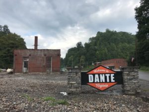 lands in the community of Dante, Virginia, have been highlighted in both the 2016 report Healing Our Land, Growing our Future: Innovative Mine Reclamation in Southwest Virginia, and the 2018 report Many Voices, Many Solutions Innovative Mine Reclamation in Central Appalachia. Though initially unsuccessful in 2017, we are happy to report that the community received $269,000 in funding as part of the DMME’s 2018 AML Pilot program after revising their application to reflect the updated needs and vision of the community. The project features a series of ATV, biking, and walking trails and the reclamation of two abandoned mine portals in the community. Additionally, the Virginia Department of Environmental Quality awarded a $215,000 brownfields assistance grant for the redevelopment at the Arty Lee School, an important part of the Dante community’s African American heritage.
2018 Projects
Devils Fork (funded) Unfortunately, the massive uptick in visitors has several drawbacks. Most glaring is that the parking lot is very small and poorly equipped to handle the 800-1,000 visitors the area sees during peak season weekends. This project approach pairs the mitigation of two mine portals and trail improvements- funded by AML Pilot- with the development of a new county-owned recreation area and parking lot- funded by an ARC Power grant. This will repair a dangerous Abandoned Mine Lands (AML) feature, and enhance a very popular tourist destination so that high volume visitation can continue in a sustainable manner. Dante revitalization (funded) The unincorporated community of Dante, Virginia and former headquarters of Clinchfield Coal Corporation, enriched by its history and culture, seeks a vision and path towards economic transition and vitality. In March 2016 the community formed the Dante Community Association (DCA), an all-volunteer group of residents and organizations, striving to transform the town through the development of a strategic plan. In 2017 the community recorded over 7,000 volunteer hours and was recognized by The Upper Tennessee River Roundtable with the “local community group” award at their spring awards banquet. The vision of the Dante Community Association: “Dante will transform its community into a model town for visitors and one that people will desire to raise a family and grow old in. This will be achieved through radical cleanup, downtown beautification, and enhanced outdoor and youth activities. Compounded by robust partnerships with neighboring towns and counties, Dante will once again see value in the homes, visitors to the town, and a resurrected sense of hope and ultimately pride in this great community, all while preserving the extensive history and small-town values.” Reclaiming Abandoned Mine Lands (AML) sites is a natural fit for this vision. The town’s history as a regional coal mining hub and the former headquarters of Clinchfield Coal Corporation place it squarely in the nexus of pre-law reclamation and economic development needs. The vision set forth is to attract visitors to the community for history around coal mining, railroad and coalfield baseball to ensure Dante’s story lives on, while looking to the future by attracting extreme sports enthusiasts seeking the rugged terrain of the area. A New Transaction The landscape of the Central Appalachian heartland is unique within the United States. Forests and post-mining lands make up the majority of land in the region, but have not traditionally been thought of as suitable for agriculture. This is now changing. Several high-value crops are very productive in these environments, and a vast opportunity exists to develop an economy around the growing and processing of these crops. The Appalachian Sustainable Development (ASD) AML Pilot seeks to bring this opportunity into reality in three ways: 1) Develop a commercial-scale pilot farm that will combine production and value-added processing with demonstration, education, and research 2) Increase the capacity of independent producers who are already practicing this kind of agriculture on a smaller scale and encourage new producers to enter the market 3) Develop local, regional, national, and international markets for these products and connect both the pilot farm and independent producers to them The pilot farm in Wise County will focus mostly on reuse of reclaimed surface mined land, and an existing forest botanical herb operation in Buchanan County will be expanded to include intensive cultivation on pre-law strip mined benches. Crops to be grown on the reclaimed mine land include: hemp for CBD, rosemary, sage, peppermint, lavender, elderberry, blackberry, pawpaw, and barley. Examples of forest crops include: ginseng, cohosh, goldenseal, and maple syrup. The on site value-added processing will include drying, milling, packing, cold storage, and essential oil extraction, with potential future expansion into craft beverage manufacturing. The Dream at Flannagan Marina The John Flannagan Dam and Reservoir, an underutilized tourism asset in Dickenson County, was constructed in the 1960s. This mountain escape has more than fifty miles of beautiful shoreline, mature hardwood tree stands, plentiful fish and wildlife, and spectacular rock bluffs. Amongst this beauty, however, are dozens of unreclaimed abandoned mine land features. Recognizing the immense potential of the reservoir to draw tourists–both local and from afar–the Oquin family of Dickenson County recently acquired the John Flannagan Marina and have invested a considerable amount of time and money into transforming the once underutilized area into a destination…and it has worked. The Dream is an AML Pilot project aimed at leveraging the Oquin Family’s investment to further transform the high-potential and picturesque lakeside area surrounding the marina into a cozy upscale mountain resort. At its core, The Dream involves the construction of three cabins, full-service camping sites, and a primitive camping area on an AML feature. SWVA Solar Springboard (funded) Global investment in renewable energy is at an all-time high. In the United States, despite low wholesale electricity rates, uncertainty about policy and incentives, and low natural gas prices, growth in the renewable energy sector continues to outpace projections. Solar photovoltaic (PV) energy, in particular, has had record-breaking growth year over year (James & Hansen, 2017). In just the first quarter of 2017, more than 2 gigawatts (GW) of solar capacity was installed in the U.S. market (SEIA, 2018). In Southwest Virginia, a group of nonprofit and community action agencies, colleges, state agencies, planning district commissions, and other interested citizens and businesses seeking to develop a solar energy industry cluster in the seven coalfield counties of Southwest Virginia. The workgroup is co-convened by the University of Virginia-Wise Office of Economic Development & Engagement, People Inc., and Appalachian Voices. (Solar Workgroup of Southwest Virginia, 2017) Development of some or all aspects of the solar industry value-chain—from component manufacturing and sales to engineering and installation—will not only grow the local economy, but also provide new businesses with abundant, redundant, and renewable energy. The development of this value-chain, however, must start with proving that large-scale solar development works in Southwest Virginia and it can support solar and non-solar jobs alike. An innovative partnership between a Virginia-based solar developer and a national data center leader aims to leverage significant private investment to take a critical step towards developing this value-chain. This solar project will consist of (8,991) 385W mono crystalline photovoltaic (PV) modules which will be ground mounted at a fixed tilt of 20 degrees at an azimuth of 176 degrees. The system will have a total installed capacity of up to 3.46MWdc. The DC electricity will be converted to grid compliant AC electricity via USA made 125kW string inverters. The power will be fed behind the load at the Wise County Data Center, both reducing the Center’s operating budgets while helping to reduce peak demand loads on the region’s distribution grid.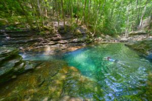 The Devil’s Fork Loop Trail is the primary access to the famous Devil’s Bathtub, a swimming, hiking, and sightseeing destination in the Jefferson National Forest in Scott County, Virginia. The trail and parking lot are maintained by the Clinch Ranger District U.S. Forest Service, along with volunteer contributions from local organizations. The site was quietly utilized—mostly by locals—for most of its existence, but thanks to some forward thinking promotion by the Scott County tourism office, the popularity of Devil’s Fork has exploded over the past four to five years.
![]()
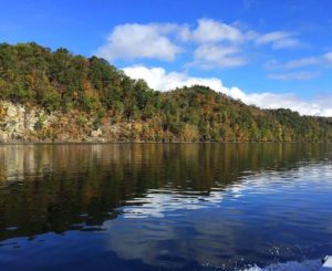
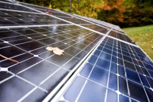
WEST VIRGINIA Projects
2019 Projects
Appalachian ReUse Corridor About This Project The Westmoreland neighborhood in Huntington, WV, has seen recent revitalization thanks in part to the launch of the Coalfield Development Corporation’s (Coalfield) West Edge Factory, the hub of its job-creation and social enterprise activities for the area. Now, adjacent to the West Edge Factory, the five-acre, 50,000-square-foot former Black Diamond facility is set to contribute to the continued economic upswing in the community by housing the headquarters of the new Appalachian ReUse Corridor. The tri-state Reuse Corridor will operate as a mixed business and employ southern WV citizens using Coalfield’s innovative 33-6-3 workforce development model, offering sustainable and well-paid positions in anything from materials reclamation to logistics. The site is complete with existing infrastructure, including key highways, the Ohio River, and a nearby major CSX Rail line, which connects major commercial, industrial, and Heartland Intermodal Gateway facilities along the WV-KY border. Ultimately, recycled materials can be moved by rail, processed at the intermodal facility, and sold internationally. Partnerships Partners include the Marshall University West Virginia Brownfields Assistance Center, Westmoreland Neighborhood Association, Westmoreland Women’s Club, Unlimited Future’s River-to-Rail Coalition, the City of Huntington, Wayne County EDA, Ohio Valley Environmental Council, and the Huntington Chamber of Commerce. Brownfield Description The Black Diamond facility is a relic of Huntington’s industrial legacy in manufacturing. The property was first built in the late 1910s and was used for metal fabrication and the production of parts for planes in WW1 and Jeeps in WW2, but it is now blighted and has multiple contaminants throughout the site. The site’s proximity to residential homes makes it a crucial cleanup priority for the sake of public health. A series of assessments using an EPA Brownfields Assessment grant indicate a broad range of contaminants, including heavy metals in soils, volatile organic compounds in soils and groundwater, asbestos in the roof coatings, and polychlorinated biphenyls and heavy metals in the building debris and concrete. While total contaminant removal is not possible, a combination of remediation steps have been recommended, including the removal of impacted soil, debris, and concrete, groundwater management and monitoring, and enrollment in the WVDEP’s Voluntary Remediation Program. Funding Sources Primary funding sources include the Communities Thrive Challenge grant award from the Chan Zuckerberg Initiative and Rockefeller Foundation, ARC POWER grants, Wayne County Economic Development Authority resources, Opportunity Funds, and an EPA Brownfields Cleanup grant. Additionally, Coalfield will be leveraging significant resources as well, using its own OSHA 10, HAZWOPER, HazCom, and other skilled workers in conjunction with environmental cleanup contractors, amounting to considerable in-kind contributions. Project Impact The reclamation and redevelopment of the Black Diamond facility into the ReUse Corridor has the potential to transform the Westmoreland neighborhood in health, economy, and environment. Once a mighty railroad, manufacturing, and coal economy at the gateway to Appalachia, Huntington is now rated as one of the poorest, least healthy, most psychologically depressed, and most opioid-impacted cities in America. The Black Diamond complex is a magnet for criminal activity, which was also the case for the nearby Corbin Factory until Coalfield redeveloped it into the West Edge Factory, which now houses seven thriving business enterprises and a workforce development training center. West Edge has paved the way for revitalization in the neighborhood, promoting engagements such as open houses, forums, art exhibits, fundraisers, concerts, and other events designed to restore a sense of community pride and progress—and converting the Black Diamond facility into the ReUse Corridor will serve to reinforce and cultivate these efforts. As a result of this project, nearly five acres and 50,000 square feet of brownfield property will be remediated for a productive end use, which will support up to 20 new and sustainable jobs and continued industrial and workforce development as the Appalachian ReUse Corridor gains traction and complements Coalfield’s other initiatives in the area. Additionally, the health and well-being of the surrounding community and future site-users will be protected through the removal of contaminants. Economic modeling of project spending related to this $500,000 project suggests it would result in a total economic output valued at more than $1.1M and provide nearly $325,000 in wages to employees in the region. West Virginia ReUse Center About This Project The West Run watershed of Monongalia County in North Central West Virginia, a tributary to the Monongahela River, is home to West Virginia University (WVU) and its organic and husbandry farms and woodlot, hospitals, large and small businesses, and numerous residents. All these entities generate organic waste but lack a local solution for it. Partnerships Partnerships will include WVU’s Davis College, which has multiple facilities and programs that produce large quantities of compostable waste, WVU Office of Sustainability, Fairmont State University, Monongalia County Solid Waste Authority, recovery-based organizations, the cities of Morgantown and Fairmont, and other regional municipalities. AML Nexus The project site is on WVU property and is immediately adjacent to West Run #1 Problem Area, which includes one P1, four P2, and two P3 problems, including a dangerous impoundment and water pollution. Coalfield will work with the WV DEP to identify and prioritize features for remediation. Funding Sources WVU is waiving the customary fee for the site and is also permitting the use of the existing wastewater infrastructure on-site, which amounts to a significant donation. Project Impact The benefits of the ReUse Center will be manifold: economic, agricultural, personal, educational, and environmental. Because no commercial compost facility exists in the area, the project will establish an entirely new line of business. The composting industry is increasingly recognized as a viable landfill alternative and its prevalence has increased fivefold since the 1990s with no signs of slowing. The proposed facility will cost over $3M, but after just three years of operation, the project is expected to serve nearly 5,000 individuals, 6 major institutions, and 25 small businesses per year. The client base is expected to climb, as any entity that handles green waste in some capacity can benefit from the facility’s services. Further, counties neighboring Monongalia, which are highly dependent on the coal industry, can provide employees, clients, and feedstocks. The ReUse Center will use the Coalfield’s 33-6-3 model to aid employees’ well-being and workforce readiness. Each week, the employee will receive 33 hours of paid work, 6 hours of higher education in a community college, and 3 hours of personal development in subjects such as financial literacy, healthy living, and life management. Economic modeling of project development spending ($3.3M) suggests the ReUse Center project would result in total immediate economic activity of nearly $7.7M, contribute nearly $2.4M in earnings to employees, support over 54 jobs across different sectors of the economy, and provide close to $4M in value-added benefits. River Cities Trail System About This Project Both rivers and trails have historically been conduits of trade and travel between cities, connecting one commercial hub to the next. Two such cities strung along the Kanawha River are Montgomery and Smithers, West Virginia. United by a bridge, they consider themselves to be “two cities, one community,” and intend to reflect that sentiment in joining their respective trails, forming the River Cities Trail System as a component of the River Cities Trail Development Project, spearheaded by the Upper Kanawha Valley Strategic Initiatives Council (UKVSIC), a formal partnership between Smithers and Montgomery. Left with an economic void following the 2016 departure of West Virginia University (WVU) Tech, the community now seeks to become a functioning trail town and gateway to the popular New River Gorge, forging a new era of industry that revolves around outdoor recreation. The project framework incorporates the two guiding principles of trail-centered rural economic development: a contiguous, marketable trail network connecting existing systems, and sustained community engagement through community programming. Partnerships The endeavor is supported by local and state entities such as UKVSIC , the Planning and Development Regions 3 and 4, the Kanawha and Fayette County Commissions, the WV Army National Guard, the WVDEP, the WVDOT, WVU, and West Virginia State University; federal agencies such as the ARC, the US HUD, and the US EPA; regional nonprofits such as the New River Gorge Trails Alliance; and various other regional businesses and organizations. AML Nexus While multiple AML features exist directly along and near the project site, priority for remediation will be given to two Emergency AML features that pose safety risks for visitors: a P2 dangerous impoundment (WV005578) near the existing trail and a P2 underground mine fire (WV005469) which may pose future issues. The total AML remediation costs are estimated to be $290,000. Funding Sources The primary funding sources include AML Pilot, local streams from the cities, in-kind donations, and federal funds. Project Impact The River Cities Trail Town Program will provide capacity-building and help the community capitalize on recreational economy opportunities by assisting entrepreneurs with business and marketing strategies, making Smithers and Montgomery more appealing to businesses and incoming residents. Economic modeling of project development spending ($3.3 million) suggests the River Cities Trail project would result in total immediate economic activity of nearly $7.3 million, contribute nearly $2 million in earnings to employees, support over 41 jobs across different sectors of the economy, and provide close to $3.8 million in value-added benefits. Tug Fork Resort The Tug Fork River weaves through the culturally significant National Coal Heritage Area and Coal Heritage Trail in the picturesque landscape of southern West Virginia and eastern Kentucky. The National Coal Heritage The benefits and functions of these cabins will be manifold. Coalfield Development crews, which are comprised of young adults from coalfield communities, will receive gainful vocational training in the building and construction trades while erecting the cabins, which will feature an assortment of customized layouts to serve as model homes. Ultimately, this project will support the overarching ecotourism economy developing throughout West Virginia and surrounding states. With proximity to such recreational opportunities as the river, forests, the famous Hatfield-McCoy Trails, and abundant cultural assets, the resort is sure to attract visitors from near and far. The cabins, reminiscent of local heritage, will ensure travelers remain seamlessly immersed in the essence of Appalachia. In addition to supporting the long-term economic climb of the coalfields, the implementation of this project will produce tangible economic impacts during construction. Economic modeling of project development costs (estimated at just over $2 million) suggests the project would result in total immediate economic activity of over $4.6 million, contribute nearly $1.3 million in earnings to employees, support nearly 30 jobs across different sectors of the economy, and provide close to $2.4 million in value-added benefits. 2018 Projects RE-CREATE (funded) The lower Cheat River watershed includes at least 342 identified abandoned mine lands (AMLs) emanating acid mine drainage into the Cheat River and its tributaries. These AMLs have severely degraded the water quality of receiving streams, including: Pringle, Lick, Heather, Morgan, and Greens Run. The decline of the coal industry coupled with infamous river disasters including the Great Flood of 1985 and major pollution blowouts from the T&T mine, has resulted in a persistent economic depression across the communities of the Cheat River Valley. With media and resources directed to West Virginia’s struggling southern coalfields, Preston County, in North-Central West Virginia, can feel like the forgotten county of coal country, while being arguably West Virginia’s premiere AML-degraded area. A project proposed by the Friends of Cheat (FOC) aims to create a recreational trail corridor (~8.5 miles) along the Cheat River in Preston County, marketing Kingwood and Rowlesburg as gateway “Trail Towns” and bringing crucial economic development activity to the area. MCSWA Campus Redevelopment The Marion County Solid Waste Authority headquarters spans nearly 300 acres in North-Central West Virginia. The primary facility on the campus, known as the Butler Building, was built nearly 55 years ago directly atop an old slurry pond for the Idamay #44 coal mine. This aging building serves as the County’s only recycling center. While the area in immediate proximity to the recycling center is used by the Solid Waste Authority, the vast majority of the property is underutilized. This underutilization, in large part, is because a sizeable portion of the property is a capped former landfill. A forward-thinking AML Pilot project aims to improve access to and renovate the Butler Building, which will improve recycling services in the county, and construct a facility to be used by the Marion County Beekeepers Association to take advantage of the surrounding underutilized capped landfill area, which is planted with grasses and pollinator crops. MARE The proposed Mixed Agriculture and Renewable Energy (MARE) project is the product of an innovative partnership between Downstream Strategies, Penn Virginia Resources, the Boone County Community and Economic Development Corporation, Coalfield Development Corporation, and others. It applies a mix of innovative agriculture, value added processing, and large-scale renewable energy to provide a diversified income base for long-term job creation. By focusing on activities that are well-suited to the conditions typical of post-mined landscapes, utilizing innovative equipment, and operating with a business-oriented approach, this model will not only be successful on Cazy Mountain but on numerous other reclaimed mountaintops throughout West Virginia. No Pastured Poultry-Project Concept The Southeast Economic and Educational Development Hub Cooperative Corporation (SEEDH) / Economic Development Greater East (EDGE) group is promoting a mix of craft distilleries, syrup production and mixed intensive grazing in southern WV and southwest VA. With a geographic center point in McDowell County WV, the group is initially focused on developing a large-scale pastured poultry system on mined lands with syrup tapping on the forested slopes below the mined areas. At least 20,000 broiler chickens per year would be raised in mobile coops on reclaimed mined lands, greatly improving the fertility of the degraded landscapes while raising healthy birds in an open air environment. They would be processed into final product with a USDA-certified commercial-scale poultry processing trailer that could be moved to other sites with future expansion. Sites would ideally be certified organic, and the pasture-raised organic meat cuts would be stored in local cold storage facilities and then distributed to local and regional markets. After a period of time undergoing fertilization with chicken manure, the reclaimed mine sites could then be transitioned into high-value crop production. On the mountain slopes below the reclaimed mine area, trees in the Acer family (sugar maple, red maple, sycamore) would be tapped for their sap which would be accumulated at a central point at the bottom of the slope for processing into syrup. This would then be bottled, labeled, and packaged for regional distribution. A Food-Safe Processing Facility (funded) West Virginia has a well-developed livestock industry with a successful track record of producing high-quality beef, pork and other proteins. However, due to the lack of critical agricultural infrastructure, most of the state’s traditional beef producers produce cattle for sale to out-of-state operators who “finish” cattle for production in other markets. This long-standing practice has made it challenging for anyone in the local food supply chain to successfully market West Virginia-grown meat products. The lack of a modern, food-safe facilities currently limits a) local sourcing options for meat retailers and wholesalers, b) processing options for local livestock producers, and c) custom, value-added WV meat product offerings, all at a time when interest in locally-raised meat products is rising. Furthermore, the lack of USDA grading services prohibits promotion of WV Grown beef, pork, lamb and other meats for their premium value, and therefore limits the vitality and capacity of agricultural enterprise in our region. Buzz Products, Inc., an established meat wholesaler with expertise in production and marketing of meat products to wholesale and retail customers, in partnership with a variety of governmental, non-profit, and education partners, has been awarded an AML Pilot grant to construct a small-scale livestock processing facility with modern, food-safety standards to satisfy the needs of Southern WV livestock producers, meat sellers and consumers. Additionally, this project aims to provide educational and on-the-job training programs to develop highly skilled workforce, targeting dislocated coal miners, military veterans, and disadvantaged young adults.
 Coalfield Development Corporation (Coalfield), a West Virginia-based social enterprise focused on rebuilding the Appalachian economy from the ground up , aims to establish the ReUse Center, the first commercial composting facility in the region. The facility will help divert waste from landfills and convert it into marketable, high-quality soil and other products to be sold back into the local community and foster training and workforce development, with emphasis on individuals exiting opioid and alcohol treatment facilities.
 Connecting the two existing trail resources in Montgomery and Smithers will benefit both the immediate communities and those associated with other individual trail systems throughout the state, serving an estimated 150,000 people. The River Cities Trail System will be poised to tie into the Southern West Virginia Bike Trail Network, directly complementing the larger tourism development initiatives throughout WV. The proposed project will initially cost nearly $4.5 million, but the expected annual return is $1.5 million—and growing—alongside both new trail connections and communities and businesses prepared to tap into West Virginia’s $9B outdoor recreation economy.
 Area Authority was granted an Appalachian Regional Commission POWER Award to establish an access plan along the Tug Fork River, transforming the river into a recreational water trail. This complementary project is poised to build on these budding ecotourism efforts by providing an additional tourist destination and lodging in the form of a resort containing 15 charming, rustic log cabins dotting a riverfront campground nestled in the heart of Appalachian history.
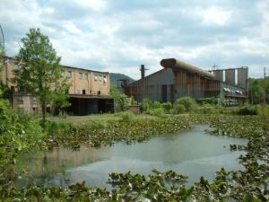
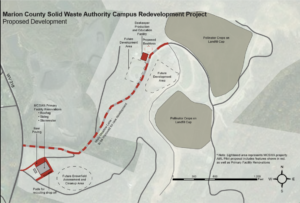
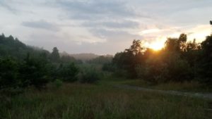
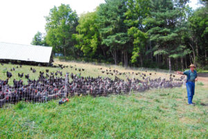

KENTUCKY Projects
2020 Projects
The Wilds of Emily Creek About this project The Wilds of Emily Creek (TWEC) is a budding 7,000-acre wilderness-based ecotourism attraction on former mine sites in the eastern Kentucky counties of Martin and Pike that promotes engagement with the outdoors through its rural location, scenic vistas, and proximity to other major points of interest in the region. The long-term development of TWEC is two-phased: improving the natural habitat and establishing the campground and related amenities. This portion of the project will fulfill the latter and build Caney Shaft, the main campground of TWEC, as well as formalize, improve, and maintain five miles of an existing network of unsanctioned trails and establish a water access area to the Tug Fork River. The trails conveniently connect the Caney Shaft campground to nearby destinations, including wildlife areas, the river, the town of Hatfield, and the hugely popular Hatfield-McCoy Trail System (HMT). Partnerships Collaborative partners include the Martin County Fiscal Court, The Appalachian Renewal Project, LLC, Boxvana, LLC, Coalfield Development Corporation, and Downstream Strategies. Funding sources The project is seeking funds from Martin County, The Appalachian Renewal Project, LLC, and Boxvana, LLC. AML Nexus The project site both contains and is surrounded by AML features, including several Priority 2 Portals, two Dangerous Slides, and two Underground Mine Fires. Although the only direct remediation planned is extinguishment of the Stepp Branch Seam mine fire, overall habitat restoration and improvement will also be conducted, paving the ground for additional remediation in the future. Project Impacts The development of TWEC will serve as an added catalyst for the exponential growth in tourism that eastern Kentucky has experienced in recent years, thanks largely to the nearby HMT and Backroads Appalachia motorsports trails destinations. In addition to supporting a blossoming recreation economy, TWEC will focus on workforce training, business creation, and land restoration. As stated, this project will develop the Caney Shaft area of the property, which will be the designated camping area and include 20 rustic cabins, 6 bay bathhouses, a 2,000-square foot general store and manager quarters, and an RV park with space for 50 RVs. The ongoing surface restoration is implementing critical conservation practices to the pastures and forests among the site, creating habitats and food sources to encourage and support the repopulation of native wildlife. Construction will be fulfilled by local contractors and tradesmen and utilize Coalfield Development Corporation’s workforce retraining programs. The construction phase of the project will generate nearly $10.5 million in economic activity, and $3.5 million in earnings to approximately 100 on- and off-site employees. Overall, the project will create 75 construction jobs, train 50 employees, create three businesses, and support 25 long-term, full-time employees. Even at just a 50% occupancy rate of Caney Shaft, it will still generate $1 million per year in lodging revenue and an addition $2 million in services and fees for campground amenities. The local tax revenue will also gain a $190,000 annual boost through TWEC activity. Total project costs for the first year of construction and operation are estimated to be $3.5 million. Projected conservation practices for habitat restoration will cost approximately $300,00 per year. Backroads of Appalachia About this Project Many communities throughout Appalachia are finding success in transforming their natural assets into vehicles for recreation and tourism. Backroads of Appalachia is a Kentucky-based nonprofit driving economic development, job training, and new opportunities to the poverty-stricken areas of Appalachia through motorsports tourism. The popularity of their existing Lynch welcome center and three motorsports trails have spurred Backroads of Appalachia to expand their presence by converting a former bank building into a flagship welcome center and rest stop that will house a photograph shop supporting a new business activity the project will establish. Partnerships Backroads of Appalachia partners with Fahe, Harlan County, the City of Lynch, and NASA Rally Sport. AML Nexus The project site is a former satellite bank building for coal miners in the historic coal mining community of Lynch, directly adjacent to the Lynch Mine Blowout AML Problem Area (KY004325) and near the coal train depot. Funding Sources This project leverages significant private investment already made in the Backroads organization and its mission. Project Impact Built in 1917 by the U.S. Coal & Coke Company, a subsidiary of U.S. Steel, Lynch grew into the world’s largest coal camp with a population peaking at about 10,000 people of 38 different nationalities and with 1,000 company-owned structures. Though a popular employer, the company is known for the drastic actions it took to prevent unionization, which earned the county the name “Bloody Harlan.” Although the region has a strong history tied to the coal industry, it is now looking to motorsports tourism to build a new economic driver for the community. Motorsports tourism encompasses motorcycles, sports cars, off-road vehicles, professional racing organizations, and more—and it remains a largely untapped resource with vast economic potential apt for the mountains of Central Appalachia. For example, a 2019 report by the University of Montana states motorcyclists seek mountains with curves and uncrowded areas; Dragon Slayer is a section of Highway 160 that offers ideal conditions such as intense curves, beautiful scenery, and low traffic. It is also located within a day’s drive of two-thirds of America’s population, making it a huge economic opportunity. Backroads of Appalachia is rapidly gaining traction in eastern Kentucky: their Facebook page reaches one to three million people each month with zero paid advertising, their Dragon Slayer trail was featured in Harley Owner’s Guide magazine as the third best destination in 2020, and their event, Ride for Hope, was featured on the AMC series Ride with Norman Reedus. Eastern Kentucky is already seeing a huge boost in tourism because of these efforts, which have had an insulative effect on regional businesses in the wake of COVID-19. After Backroads of Appalachia’s welcome center opened, Emma’s Southern Style Restaurant in Lynch sold out of BBQ and continues to prosper. The local T-shirt company, Game Day Designs, was in jeopardy of closing, but instead had to hire two new staff members to keep up with the welcome center’s demand for shirts. In early August, economic activity was further stimulated by Kentucky’s first rally race, organized by NASA Rally Sport. Economic impact studies of rally races indicate they bring in millions of dollars in tourism spending to local areas during a single weekend race. Backroads of Appalachia is now working to expand this relationship to help other former coal towns capitalize on natural assets to recruit motorsports tourism. Backroads of Appalachia’s work is projected to create 6–10 direct jobs and generate an economic impact of $2.7M to $3.7M in 2020, and more in years to come. Cumberland Forest ORV Trail System About this project The Nature Conservancy’s Cumberland Forest Project spans 253,000 acres in Kentucky, Tennessee, and Virginia in one of the most important geographies for conservation—the Central Appalachian Mountains. This project will focus on the portion of the forest in Bell County, Kentucky, which sees heavy traffic by off-road vehicle (ORV) users in a large network of unsanctioned trails. The estimated 111 miles of user-developed trails are not currently permitted for ORV access despite their frequent use, and they have never undergone maintenance or regulation, which means the network is very likely degrading the surrounding environment. Specifically, over half the trails within stream corridors are adjacent to streams designated as Outstanding State Resource Waters, which feature the highest quality water and contain federally threatened and endangered species. The Cumberland Forest ORV Trail System will formalize and market the existing trail system while decommissioning routes that compromise the forest’s ecological integrity. The trail system will usher in a new and significant stream of revenue into the local communities through outdoor recreation and motorsports tourism, which have become very attractive economic development options for other areas in Central Appalachia and bring in millions in income and tourism spending every year. The trail system will establish Middlesboro, Kentucky as a destination Trail Town to serve as the hub for regional activity and will also connect to existing out-of-state ORV systems through downtown trail linkages. Partnerships Partners include Kentucky Mountain Regional Recreation Authority, Cumberland Valley Area Development District, CF-Ataya LLC, Middlesboro City Council, Bell County Tourism, and Bell County Fiscal Court. Funding sources The project has secured funds from The Nature Conservancy, Bell County Tourism, and Bell County Fiscal Court. AML Nexus The project site has an extensive history of coal mining and contains several AML features, two of which have been previously remediated by the AML Pilot program—a water supply and vertical openings. This project will specifically target areas that have achieved bond release status, and while it will not include direct AML reclamation, it will ensure former AML areas have a productive end use in community and economic development. Project Impacts The development of the Cumberland Forest ORV Trail System will build a recreation and tourism enterprise that will yield much needed long-term economic gains for Bell County and the surrounding region. Once a top coal-producing county, the county has suffered an 81% decrease in coal production and a 79% decrease in coal employment since 2000, which have contributed to the county’s 31% poverty rate and low median household income of $24,628. Bell County is primed for the opportunities the trail system will launch into the community. All total, the project is expected to cost approximately $6 million to complete and begin operations, with about $1.9 million in direct trail and visitor center construction costs. During the construction phase, this project will generate an economic output of $3.5 million, provide $1 million in earnings to employees, support more than 20 jobs, and contribute over $1.8 to the local GDP. However, the bulk of the benefits will be realized in the long term. Nearby examples ORV systems boast annual returns in the tens of millions and employ hundreds of full-time equivalent (FTE) employees: The Spearhead Trails in Virginia and Hatfield-McCoy Trails in West Virginia employ 198 and 430 FTE jobs and generate $16.7 million and $38 million in economic impacts per year, respectively. Additionally, the trails yield between $400,000 and $1.3 million in annual tax revenue increases. Other ORV systems in the region draw an impressive 91% of their visitors from out-of-state and routinely generate over $10 million in annual visitor spending. The Cumberland Forest ORV Trail System will attract approximately 50,000 visitors per year, spend an average of $221 per trip, and produce comparable economic impact numbers as other regional ORV trail systems. Much of the future economic activity will center in and around Middlesboro, which will capitalize on opportunities for expanding its tourism infrastructure and promote new business opportunities by becoming a Trail Town. 2019 Projects Pikeville YMCA Wellness Center About This Project Kentucky’s Pikeville area community is rejecting the trend of ill health in rural areas by focusing on quality of life and new economic opportunities. The Pikeville Area Family YMCA’s programming and facilities emphasize the health and wellness of community members. Since it opened its doors in 1985, the YMCA has strived to continually improve its facilities to best serve its users, which include 3,300 current members (and growing) and 2,500 visitors. Partnerships There is broad community support for the Wellness Center in Pikeville. The YMCA already has several entities onboard and ready to commence the project, including Rusty Justice, Elliott Construction, Community Ventures, State Electric, and Baird and Baird Attorneys. AML Nexus The Pikeville Area Family YMCA is located adjacent to the Pikeville Cut Through Project and actually sits atop fill from that historic project. Additionally, the YMCA facility sits below a remediated P1 dangerous slide (KY003630). This slide was remediated for nearly $112,000 from the traditional AML Fund. Without this vital stabilization, the YMCA could not exist where it does today. Additionally, the YMCA has an extensive history of serving miners in Pikeville and beyond. Staff estimates that around 165 members are active miners and many more are retired miners. The YMCA has provided child care and financial scholarship to assist families transitioning out of the mining industry upon its decline. Additionally, its facilities are used for annual mine safety training and drills for miners from Kentucky and surrounding states. Funding Sources Through an effort to raise donations and fundraise for the Wellness Center, the YMCA has successfully raised enough money to pay for the warm water aerobics/family pool ($440,000). However, money is still needed for the outdoor splash pad, sun deck patio, and the parking area. This, totalling about $425,000 in expected cost, is the subject of a future AML Pilot Application. Project Impact Thanks to the influx of industries and employment opportunities in Pikeville and the rapidly growing student body of the University of Pikeville, the demand for expanded and updated wellness and recreational services is only increasing. The YMCA expects to boost its membership base by 300 in the first year followed by a 1.5% increase in subsequent years. The outdoor splash pad and nearby picnic seating will allow youth and adults alike to enjoy outside activities together. The outdoor patio will provide a refreshing site from which families can supervise their children as they participate in physical activity. These new features will attract additional users, so the new parking lot will ensure all members and guests are accommodated. Pikeville prides itself on the high quality of life it cultivates for the community, which studies point to as being particularly vital for small, rural towns. The expansion will not only provide 20 to 30 new jobs to residents but improve access to the enhanced facilities and community programming. This will yield innumerable benefits to the overall well-being of individuals in the community: prevention of chronic diseases, the development and maintenance of a healthy body, mental health improvement, stress relief, and an extended lifespan. The implementation of this project will produce tangible economic impacts during construction and beyond. Economic modeling of project development costs (estimated at approximately $1M) suggests the project would result in total immediate economic activity of over $1.6M, contribute nearly $422,000 in earnings to employees, support nearly 9 jobs across different sectors of the economy, and provide close to $1M in value-added benefits. Brownfields Primer Introduction Across Central Appalachia and other areas dealing with post-industrial economic decline, a glut of vacant, dilapidated, or condemned properties offer challenges and opportunities to communities seeking new economic opportunity and growth. Many of these properties can be considered brownfields, where environmental contaminants like asbestos, molds, or toxins from past use hamper the redevelopment of the property. One common type of brownfield property found in many historic Limited and competitive federal and state grants are available to nonprofits and municipalities to aid in the cleanup and redevelopment of brownfield properties. In 2017, Appalshop and partners at Appalachian Citizens’ Law Center (ACLC) and the Environmental Law Institute began investigating the potential of using these and other funds to redevelop a former dry cleaners’ building in a downtown in Eastern Kentucky. While the project has not yet come to fruition, it provides insight into some of the possibilities and challenges faced by communities with former dry cleaners or other brownfield sites in downtown revitalization efforts. Project Description In 2017, it was brought to Appalshop’s attention that a former dry cleaners’ building had been put up for sale. The property was in a prominent location for foot and vehicle traffic in a once-bustling downtown area now struggling with the decline of the coal industry. With the potential to catalyze further revitalization downtown, the building’s location makes it a good candidate for community development projects envisioned by Appalshop and community allies, which include a business incubator, affordable artist residency space, art studio, performance space, and co-working facilities in an area with limited move-in-ready locations for new businesses. In consultation with environmental law experts, Appalshop approached the owner about assessing the property for its brownfield status. An assessment grant was awarded through the Kentucky Department of Environmental Protection’s Brownfields Unit to carry out a Phase 1 Environmental Site Assessment (ESA), and a Phase 2 assessment as necessary. The Phase 1 ESA suggested that environmental contaminants likely did exist, and that a Phase 2 assessment should be completed. Phase 2 ESAs can include soil, water, and materials sampling to gauge the extent of contamination from brownfield properties. Appalshop approached the owner to discuss possible paths forward. While they were amenable to gifting the property to Appalshop or another non-profit to support economic development, they were concerned about the potential liabilities extending from federal brownfields laws. Under the CERCLA legislation, any past owners of brownfields properties can be held liable for the cost of clean-up from brownfields properties, regardless of their contribution to or knowledge of past contamination. Obstacles and Challenges While the future of this project is uncertain, it has demonstrated some of the obstacles and challenges to downtown revitalization, reclamation of contaminated brownfield sites, and community development in the coalfields of Central Appalachia. These obstacles include: While these obstacles are not unique to Appalachian coalfield redevelopment efforts, they are different than those faced by communities with higher growth and economic health. Overcoming these obstacles is required to see the successful cleanup and revitalization of brownfield sites, which can catalyze further downtown economic revitalization in these communities. We hope that supporters of these efforts across the country can find ways to support coalfield communities seeking to overcome challenges and revitalize their downtowns. Economic Impact Indeed, brownfield redevelopment in Central Appalachia can be a difficult and confusing process. However, for communities that undertake the endeavor, the potential economic impacts are immense. As noted, depending on the circumstances, remediating a property that was formerly used as a dry cleaners can exceed $1 million. So, after reconstructing the site for the desired use, a community organization or developer could easily be $1.5 million into the project. Assuming this budget, economic modeling of project development spending suggests the project would result in total immediate economic activity of nearly $3.4 million, contribute nearly $1 million in earnings to employees, support nearly 22 jobs across different sectors of the economy, and provide close to $1.8 million in value-added benefits. 2018 Projects Kentucky N. Fork Kentucky River Makerspace Like much of Central Appalachia, the City of Whitesburg has faced many challenges in the face of the shrinking coal industry. However, residents, organizations, and elected officials are working together to spur a more vibrant economy that will improve the quality of life and ecological health of the area. This, through a project that involves the demonstration of AMD remediation techniques, the creation of a river-walk trail and other recreation opportunities, and the refurbishment of an existing community asset to enhance community and workforce development activities. The North Fork Kentucky River Project would utilize AML Pilot funds to create an AMD remediation park of sorts. Here, the project team will employ passive and ecological remediation techniques to treat water from an AML-impacted stream to demonstrate and educate visitors about the process and importance of improving water quality from the area’s rivers and streams. Further, the project would improve public access to the water, including 700 feet of river-walk and public walking trail; a kayak and canoe launch ramp; environmental education signage; a basketball court; and a streamside performance stage. Finally, adjacent to the AMD remediation park, Pilot funds will be used for the refurbishment of Appalshop’s Boone building, including the development of artist and musical studios, expansion of a digital classroom, installation of a cutting-edge media lab, and development a makerspace for training in hands-on skills–from 3D design and printing to blacksmithing and sculpture. South Fork Elk View (funded) The South Fork Elk View area of Breathitt County, near the City of Jackson, is known regionally for its wild elk and free-roaming horse viewing and off-highway vehicle and horse trail riding opportunities. Indeed, the tourism potential for this part of Kentucky is great. One project, on a former surface mine, aims to capitalize on the strengths of the area and create a destination for people from Kentucky and beyond. The South Fork Elk View Campground and Expo Center project is the continuation of an AML Pilot project, sponsored by the Breathitt County Fiscal Court, that was funded in 2017. Phase 1 focused on bringing utilities to a reclaimed post-SMCRA mine site, where, during Phase 2, project partners will develop a campground area, which will include 20 tent sites, 24 RV hook ups with electric and water, 11 cabins, a visitors center, and a horse expo center and show arena. Affordable Green Energy Subdivision Once a thriving coal town, Allais, Kentucky, is now dotted with many vacant and dilapidated properties. One such property, however, may have a brighter future through a forward-thinking AML Pilot proposal. Led by the Housing Development Alliance (HDA), this project would transform a dilapidated and abandoned strip mall into an energy-efficient housing development for disadvantaged people. The 38,000-square-foot former business center is adjacent to a former mining site and has become a danger and an eyesore within the community it once served. HDA proposes to purchase, demolish, and redevelop the property, repurposing it as the site for 15 new homes as part of the Affordable Green Energy Subdivision (A.G.E.S.) project. Allais is a community with critical needs: As coal a coal-dependent community, Allais has suffered from local job and regional losses, increasing poverty, and a declining tax base. This project is designed to tackle these needs head-on. The 15 new homes in the A.G.E.S. development will increase the number of affordable homes in the community, which are currently in limited supply. Built with solar panels and cutting edge “green” design, these high-quality, long-lasting homes will be both energy efficient and affordable for disadvantaged residents. This project will build on efforts underway to rebuild the local housing market, bringing an increased tax base for local governments and sustainable equity for the area’s low-income and working-poor families. Modern Energy at Arlie Boggs Despite rising energy costs, Kentucky schools are spending less on energy than they were in 2010, thanks in large part to energy efficiency initiatives like the School Energy Managers Project. That program alone has returned over $225 million in savings to the classroom and has brought Kentucky national notoriety from the Environmental Protection Agency. Recently, Arlie Boggs Elementary in Letcher County garnered regional attention for its efforts to reduce energy costs with solar power. This project not only saves the school money, but also serves as an opportunity to educate students about a rapidly evolving 21st century industry. However, right now, the size of the system (3 panels) only reduces the schools energy consumption by about $600 each year. The AML Pilot program, offers the school, which is a stones throw from a large Priority 3 AML feature (Franks Creek Strip KY002626) and in a community where both pre- and post-law mining has been integral to the way of life, an opportunity to 1) scale up the size of its solar array and associated savings, and 2) expand educational opportunities for students about energy efficiency and renewable energy—a growing portion of the regional economy. Whitesburg Recycling Expansion Whitesburg, KY currently operates a small but very successful recycling program and they are keenly interested in shoring up their operation and expanding into new, and much needed, services. Adding a truck tractor to their slate of equipment will empower them to expand services and tackle new market opportunities, and entering into the tire grinding business will fill a gaping hole in recycling services of southeastern Kentucky. Whitesburg’s recycling program is a regional leader. With one exception (Perry County), Whitesburg is the only major recycling program in this region of southeastern Kentucky. Any expansion of Whitesburg’s facilities has the potential to have a positive impact on the region as a whole. There is one even more significant service gap in the region, however: tire recycling. Much like the rest of Central Appalachia, cast-off tires are a problem in southeastern Kentucky, often finding their way to streams. The state of Kentucky operates a disposal program that includes amnesty (ie, free) disposal days, but outside of those events, disposal costs are high and several regional governments report difficulties with tire disposal. The problem could potentially be mitigated through a tire grinding operation. The primary aims of this project are to obtain a truck tractor, develop a business plan for the current recycling facility that includes expanding into a tire grinding operation, and start the tire grinding operation, including the purchase of several specialized pieces of equipment, site design, and site development. The business plan portion of this project will include identifying sources of tires, establishing relationships with waste tire brokers, and developing a 5 year pro-forma of expected costs and revenue. Understanding the likely available quantity of waste tires will allow the operation to make an informed decision about the capacity of equipment that will be purchased. Today, a transformational project to develop a 7,000-square-foot Wellness Center aims to improve the Y’s ability to serve the Pikeville community, which will provide tangible benefits to public health and make the community more attractive to potential businesses considering locating there. The project, which leverages significant investment from the traditional AML fund and other sources, will result in the construction of a warm water aerobics and family pool and new amenities like an outdoor splash pad, a sun deck patio, and an improved parking lot.
 downtowns in Central Appalachia is former dry cleaner sites. Before the 1990s, many dry cleaners used toxic chemicals without proper disposal options. These chemicals were sometimes disposed of on-site. They can persist and spread in the immediate environment, can be costly to clean up, and possibly pose long-term health risks to neighboring properties and communities.
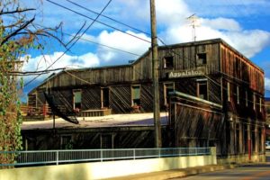
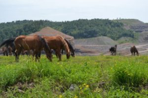
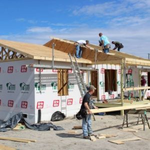
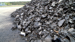
ALABAMA Projects
2020 Projects
Runway for Reclamation Cawaco Resource Conservation & Development Council, Inc. received a RAC mini-grant to assist partners of the Alabama Rivers & Streams Network in developing capacity to prioritize and develop abandoned mine reclamation projects that will improve water quality and improve economic conditions for coal-impacted communities. The grant will help the Council integrate the AML Inventory GIS with Geological Survey of Alabama Strategic Habitat Units maps; use the map to identify potential areas of cooperation; collaborate with partners to identify priority projects; collaborate with Downstream Strategies to develop economic strategies for the projects; and prepare and submit AML Pilot applications. North Fork Creek Project About this project The North Fork Creek project, Problem Area Number AL000711 in the AML Information System, will address 700 feet of a dangerous highwall that averages 40 feet in height, 68 acres of spoil, and more than 500 gallons per minute of water polluted with acid mine drainage that now flows into North Fork Creek in the Brookwood area of Tuscaloosa County. Reclaiming this site will improve water quality in North Fork Creek and downstream in Hurricane Creek. Despite the pollution discharged into North Fork Creek, Hurricane Creek supports diverse aquatic life including, for example, largemouth and smallmouth bass, sunfishes, and catfish. Local residents fish, canoe, and swim in Hurricane Creek and ride four-wheelers along the creek. A University of Alabama class uses Hurricane Creek for field trips because it is close to campus and an accessible field teaching location. Approximately five years ago, Tuscaloosa Parks and Recreation took responsibility for the maintenance of a parking area on Hurricane Creek, ensuring access for recreation. Hurricane Creek is used primarily by local residents and is not a tourist destination. No outfitters provide services for visitors who wish to recreate there. Partnerships The project is the product of a collaboration between Cawaco Resource Conservation & Development Council and the Alabama Geological Survey with support from the Reclaiming Appalachia Coalition. AML Nexus The primary project activity is the reclamation of over 700 feet of dangerous highwall and remediation of 68 acres of spoil. Funding sources The project will be funded entirely through the AML Pilot Program. Project impact Reclaiming the North Fork Creek AML will not just provide environmental benefits; it will also provide economic benefits to the local area. The most immediate local benefits will result from designing, building, and maintaining the treatment system, which is estimated to cost $2.0–2.25 million. If provided by a successful AML Pilot Program grant, money spent on this reclamation project would come from a federal source outside of the local area. So long as Alabama businesses are used to provide the goods and services required to reclaim the site, jobs will be created and wages will circulate through the local economy as workers spend their paychecks on other local goods and services. For example, engineers will be needed to design and oversee construction, a construction firm will be needed to build the treatment system, and environmental consultants will be needed to monitor water quality. Economic modeling of project costs suggest that the project would result in total economic activity of $3.7–4.2 million, support 22-25 jobs on- and off-site, and provide over $1 million in earnings to workers.
PENNSYLVANIA Projects 2020 Projects A Solar Suitability Tool for the PA Coalfieldsl About the Project EPCAMR has developed a site selection tool that identifies locations for potential solar energy projects on abandoned mine lands. As of right now, the tool has identified 18 sites across 5 different counties among the anthracite region of Pennsylvania totaling over 1200 acres of AML land for potential solar development. Site sizes ranging from 19 to 280 acres and qualify for funding through the AML Pilot Program. The selection tool utilizes ArcGIS’s Model Builder to synthesize different raster datasets into a suitability model. Digital Elevation Models (DEMs) of AML sites across the four anthracite fields of Pennsylvania were used to determine the slope, aspect, and potential solar radiation. The model also included the National Land Cover Database, distances to substations, powerlines, roads, streams, and wetlands. EPCAMR will use the information gathered from its modeling exercise to work with public and private partners to investigate further into the history of these sites. The goal of the organization is to serve as a liaison to connect landowners with potential solar developers and expedite the re-use of AML sites in Pennsylvania. Partnerships EPCAMR has partnered with Reclaiming Appalachia,, AC Power, the Earth Conservancy, Wilkes University, King’s College, and the Office of Surface Mining Reclamation & Enforcement’s AmeriCorps Volunteers in Service to America (VISTA) Program through Conservation Stewards, and The Just Transition Fund to develop and complete the first phase of the project. AML Nexus This project analyzes the suitability for solar energy development on all the abandoned mine lands in the anthracite regions of Pennsylvania. Many already reclaimed mine lands make ideal sites for converting into solar energy. Often these sites are just empty fields not being utilized for any other beneficial use besides being revegetated to stabilize the slopes and the soil. The potential for economic redevelopment of these sites are very promising and can lead to jobs, workforce development training, lower utility pricing, community development, alternative energy options for consumers, and new solar developers and investors coming to Northeastern Pennsylvania. EPCAMR’s model has also identified several sites on lands owned or leased by former Co-Generation plants in the Anthracite Region, which make excellent options for solar energy development because the infrastructure is already on-site and can tie into the existing grid. EPCAMR will reach out to ARIPPA, the trade association that communicates with the remaining few Co-Gen Plants in the Commonwealth. This project shows that abandoned mine land sites in Pennsylvania do have great potential for solar energy projects. The framework that EPCAMR has built will allow us to look at rooftops, private and public lands that are not classified as abandoned mine lands and other large impervious surfaces down the road, should funding or professional services be needed by the private sector to investigate the potential for solar development on those areas. Funding Sources The ultimate redevelopment of AML sites for solar could be funded through a mixture of public and private sources. 2019 Projects Moonville Rail Trail About This Project The Moonville Rail Trail takes users through 16 miles of Appalachian scenery in southeast Ohio, past such attractions as the Zaleski State Forest, Lake Hope State Park Partnerships Partners include the Moonville Rail Trail Association, Vinton and Athens County Commissioners, Raccoon Creek Partnership, Zaleski State Forest, Lake Hope State Park, Uncle Buck’s Riding Stable, Athens County Planning Office, and Vinton County Convention and Visitors Bureau. AML Nexus The project site encompasses eight P2 portals that pose public health and safety hazards due to their location on public property. The features are near the Moonville Rail Trail and are also scattered on either side of the Zaleski Backpack Trail. The removal of these hazardous features will directly complement the increased trail access. Total abatement will cost approximately $35,000. Funding Sources Funding for the project comes from ODOT, the Clean Ohio Fund, Land and Water Conservation Fund, and donated bridge trusses from Athens County Engineer. Project Impact Once the bridges are erected, rail trail users will have complete, connected rail trail access along a 12.2-mile stretch and the potential for a future connection to the 21-mile Hockhocking Adena Bikeway just 4 miles away, expanding the project’s contribution to the greater regional rail trail network. Based on visitation data collected, the conservative estimate for annual usage is about 60,000. This connection will open a crucial hub of economic and community development that will bolster the current suppressed state of the Zaleski and Mineral communities. By safeguarding the mine openings and upgrading the full length of the rail trail, tourist activity and economic development are expected to rise significantly, with services being enhanced or created, such as bike rental businesses, retail opportunities such as food and drink, entertainment, and services, increasing utilization of nearby Uncle Buck’s Riding Stable and the Lake Hope State Park, which hosts about 300,000 people per year. Because rural communities have limited corporate hotel presence, Airbnb locations have expanded in areas popular for outdoor recreation, providing local business opportunities for locals and accommodations for visitors. Improving, connecting, and expanding the trail will facilitate more hiking, jogging, and other foot traffic activities, all of which are rated as the most popular outdoor activities and are associated with improved health and well-being for participants. Economic modeling of AML Pilot project development spending ($1.2M) suggests the Moonville Rail Trail would result in total immediate economic activity of nearly $2.8M, contribute nearly $1M in earnings to employees, support nearly 22 jobs across different sectors of the economy, and provide over $1.5M in value-added benefits. Connecting to the 21-mile Hockhocking Adena Bikeway could yield nearly $22M of new economic impact and 236 jobs. Truetown Pigments (2019 update) About This Project Acid mine drainage, often presenting as rusty colored deposits polluting thousands of Appalachian streams and regarded as an eyesore, is being converted into something inventive, marketable, and environmentally healthy: pigment. With AMD-to-Paint Pigment technology, created by Dr. A pilot plant operating at the research scale has successfully been producing effective pigments, demonstrating potential profitability and producing well-received artwork and community projects. This project will establish the plant for True Pigments LLC, the entity Rural Action registered to operate. Partnerships Contributors include Rural Action, Ohio University faculty, OH DNR, paint companies, including Gamblin Artists Colors, TechGROWTH Ohio, Athens County Planning Office, and landowners. AML Nexus The Truetown discharge site is inventoried as a P3 water feature. The discharge is situated on a pumping station for an abandoned coal mine. Funding Sources This project is supported by the Ohio Environmental Protection Agency Water Resource Restoration Sponsor Program, a Natural Capital Investment Fund loan, an anonymous donor, the Sugar Bush Foundation, Mr. Dick Dickerson, Finance Fund Economic Development, Athens County Foundation, Foundation for Appalachian Ohio, One Foundation, Stream + Wetlands Foundation, and the T.R. Wells Foundation. Project Impact While upscaling to production is expected to cost around $7.5M, the facility should serve as a boon, and ripple effects created by a new industry will yield significant economic impacts, including direct long-term employment opportunities. Further, because Rural Action is a local non-profit organization, the revenue will be reinvested into additional watershed treatment infrastructure, staff, monitoring, and education—all stemming from the creation of the healthier watershed spawned by the AMD-to-Paint Pigments treatment facility. Economic modeling of AML Pilot project development spending ($3.1M) suggests the Truetown project would result in total immediate economic activity of nearly $7.8M, contribute nearly $2.6M in earnings to employees, support over 55 jobs across different sectors of the economy, and provide over $4M in value-added benefits. Tuscarawas Regional Technology Park Ohio produced 11.3 percent less coal this year than in 2017, and that trend will only continue with impending local coal-fired power plant closures and hundreds of associated layoffs. However, the introduction of new industries and employment opportunities will contribute to the economic diversification and development unfolding in the region. Strategically located on 160 acres outside of New Philadelphia, Ohio, theTuscarawas Regional Technology Park will house businesses committed to long-term investment in eastern Ohio. Portions of the property have been impacted by underground coal mining, with some areas being abandoned since the early 1920s. Abandoned mine land (AML) features include a hazardous, partially collapsed vertical opening and acid mine drainage. Further, a consistent challenge to development has been the ability of businesses to see past the uneven terrain characteristic of AMLs. In addition to reclaiming the AML issues, the site can be leveled and basic site preparations completed, resulting in a “shovel ready” location suitable to show prospective investors and businesses. Preliminary estimates for reclamation of these AML features suggest a cost of just under $3 million. However, the Tech Park could provide a solid foundation for innovative business investments and a re-shaping of the economy in eastern Ohio. Wellston Recreation Complex As coal and other extractive industries continue to decline, more areas are pursuing recreational tourism to bolster the local and regional economy. The Wellston Recreation Complex provides the 5,600 youth and adults of the city of Wellston, Ohio, with baseball, softball, and soccer fields for games in spring through fall, as well as sport camps. Make Wellston Beautiful, a volunteer-based 501(c)(3) organization responsible for the complex, has steered it toward enhanced recreational opportunities, tournament play, significant participation increases, and a program revenue jump of 350%. However, pre-law surface and deep mining occurred on or below a significant portion of the complex site. Numerous dangerous surface mine impoundments border the site, some of which will be eliminated as part of the project. Preliminary cost estimates for the Wellston Recreation Complex total near $1 million. Economic modeling of project development spending ($1M) suggests the project would result in total immediate economic activity valued at $2.2M, contribute nearly $700,000 in earnings to employees, support nearly 15 jobs across different sectors of the economy, and provide near $1.2M in value-added benefits. 2018 Projects D.O. Hall Business Center Expansion (funded and completed) The Community Improvement Corporation (CIC) was created by the Guernsey County Commissioners in 1965 and designated by resolution to perform the economic development functions for the county, City of Cambridge, and Village of Byesville. Central to its mission of bringing economic development to this area of Ohio is the D.O. Hall Business Center, a new commerce park that offers many advantages to prospective development in Guernsey County. Current educational, service, and business entities located in the park include Zane State University, Southeast Ohio Regional Medical Center, Detroit Diesel, Ridge Tools, Federal Express, Ascent Resources, and Plastic Compounders. A drilling and grouting AML Pilot project to stabilize the surface of a nine acre parcel from deep mine subsidence was proposed by the CIC and Rural Action to expand developable property in the Business Center with the expectation of opening opportunities for more businesses to locate there. The CIC estimates that 74 jobs will be created with $6 million in capital costs expended. The Ohio Department of Natural Resources Abandoned Mine Land Program recently completed this project at a cost of $954,593. Camp Tuscazoar Dessecker Recreation opportunities are in high demand in Tuscarawas County, Ohio. Tourism in the county, which generated $410.5 million of direct and indirect sales in 2017, is largely centered on a 600-acre public recreation area maintained by Camp Tuscazoar. Copious trails, mountain bike races, and adventure events hosted by Camp Tuscazoar attract thousands of day-use visitors to the area each year, but the county seeks to build its tourism base among overnight visitors, which could likely triple the overall economic impact from recreation. Led by the nonprofit Camp Tuscazoar Foundation, efforts underway are transforming a former site into a campground and trail system within Camp Tuscazoar’s “Hidden Mine Recreation Area.” By creating new camping facilities, this project will encourage visitors to stay longer in the area, creating more demand for secondary services such as food service, retails sales of outdoor equipment, supplies, and potentially other overnight accommodations. The Hidden Mine Recreation Area is poised to become a high-volume tourism destination in eastern Ohio–one that will showcase AML reclamation as compatible with outdoor recreation and sustainable development. Located on the former Dessecker Mine site, over $1.2 million has been invested to date in this project to acquire the 218-acre parcel, remediate mining impacts, and plan for recreation development. The Ohio Department of Natural Resources completed reclamation of the site in August 2018 with a total of $702,000 in AML funding. Truetown AMD Paint Pigment Production (funded) Acid mine drainage (AMD) impacts thousands of miles of streams across Appalachia, including a significant portion of the Sunday Creek watershed in southeastern Ohio. However, through an engineered chemical process, a project in Athens County, Ohio aims to convert polluted AMD-impacted water into job opportunities for locals. An unlikely cross-disciplinary partnership between a Rural Action watershed coordinator and a scientist and artist at Ohio University has resulted in an innovative treatment and reuse of byproducts from acid mine drainage. The treatment process developed at Ohio University enables the removal of iron and neutralizes acid. The iron removed will be used in the production of a viable iron oxide pigment product for commercial sale to produce highly sought after paint pigments. It has been estimated that this reuse will demonstrate profitability that more than offsets AMD treatment costs. The proposed project, estimated at $7,471,619, including $3,489,408 in Pilot funding, will construct a facility that will treat an AMD discharge of 988 gpm that currently flows unabated into Sunday Creek, grossly polluting it for 7.5 miles. The treatment facility will remove iron for use as paint pigment while discharging clean water to the creek. The Pilot funds will be used for reclamation and site preparation for the treatment facility, which will be constructed in a subsequent phase. These funds will relocate the mine discharge to the proposed treatment site, reclaim the current discharge site and existing channel, treatment facility site preparation, construction of settling ponds, placement of infrastructure including electric and water utility installation, operation support equipment, and final design of the treatment facility. The balance of the project funding, derived from OEPA, private foundation, and USDA Rural Development funds, will support construction of the treatment facility. The project’s design will be completed in 2019, the AML reclamation and site development completed in 2020, and the treatment facility constructed in 2021, with treatment beginning late that year. Bailey’s Mountain Bike Trailhead (Pilot funded) Rural Action, Inc., in partnership with the U. S. Forest Service and the Ohio Department of Natural Resources, among other partners, have proposed construction of an 88-mile mountain bike trail within the Wayne National Forest in Athens County, Ohio. It will include construction of a critical access point of ADA accessible trail on the Buckeye Trail/North Country National Scenic Trail to the National Register Historic District of the Village of Shawnee, located in Perry County. It will also include the construction of trailheads to numerous communities (Chauncey, Doanville, and Buchtel) on non-U.S. Forest Service property, which will aid diversification of the economy of these communities and the historic coal region in general through outdoor recreation and tourism. It has been estimated that 181,000 visitors will use the trail system within the first decade of its existence and that $24.8 million in local economic spending will occur with $8.6 million in additional wages created and 65 jobs created and retained. The estimated comprehensive cost of the five-year project is $5.4 million, with funding being sought by Rural Action from an ARC POWER grant, a Pay for Success funding approach through Quantified Ventures, and foundation and Pilot Program funding provided by the Ohio Department of Natural Resources, the latter of which amounts to $1,791,887. In addition to construction, ARC funding will catalyze entrepreneurial opportunities, design collaborative brands and a national marketing campaign, provide entrepreneurial support, sector training, workforce employment and intensive technical assistance to local individuals, businesses and communities. Connectivity to the trail, via anticipated trailheads owned by the individual communities, is challenged by surface and underground mine features including two Priority 1 mine openings, a Priority 1 hazardous facility, and a Priority 2 subsidence feature. Pilot Program funding will be directed toward these features as well as trailhead development at Chauncy and the Hockhocking Adena Bikeway. Tecumseh Lake Recreation Area Rural Action, Inc., in partnership with the Buckeye Trail Association and the U. S. Forest Service, have proposed enhancement of a 50-acre recreation area within and bordering the Wayne National Forest in Perry County, Ohio. The estimated total cost of the multi-phase project is expected to be approximately $2 million, with funding being sought from USDA National Forest funding programs and Pilot Program funding. There has already been an investment in the area by the Buckeye Trail Association, amounting to $25,000 in leveraged labor and financial match. The project will include construction of ADA accessible trail on the Buckeye Trail/North Country National Scenic Trail, connecting the recreational site to the National Register Historic District of the Village of Shawnee, located in Perry County. This project is part of the larger effort to revitalize and diversify the economy of the communities and the coal region in general through outdoor recreation and tourism. Shawnee, the community this project would connect to increased recreational opportunities, is home already to a large number of civic organizations dedicated to economic diversification, such as The Little Cities of Black Diamonds council. Safe use of the recreational area is challenged by surface and underground mine features noted in the Mining Features section below.
OHIO Projects wetland areas, the Zaleski and Mineral communities, and two particularly unique and historic tunnels. The King’s Hollow Tunnel is a 120-foot structure carved through the sandstone and lined by a series of wooden beams. The infamous brick-lined Moonville Tunnel, in the ghost town of the same name, is featured in many ghost stories, thanks to its long history of train accidents. However, these tunnels—and the remainder of the trail—have limited accessibility, because the bridges across the Hewett Fork were removed, and high water poses a hazard to those who cross the creek to continue their journey. This project will make the sought-after Moonville Rail Trail interconnected and open to horseback riders, joggers, and bicyclists alike by installing seven bridges, restoring the trail, and eventually adding additional trail connections.
 Guy Riefler at Ohio University (OU), a legacy of pollution can give way to a new era of industry. Commonly used acid mine drainage (AMD) treatments—such as steel slag leach beds and lime dosers—neutralize the acidity, which significantly improves the watershed overall but causes metals to accumulate in the stream, leaving the treatment area with highly concentrated pollution. In contrast, the innovative AMD-to-Paint Pigment technology removes not only the acidity but the iron precipitate. The iron is then repurposed into marketable pigment.
 The treatment system will function similarly to a wastewater treatment system. The clarification process also extracts 2,183,065 pounds of iron oxide per year, which is then processed into a paint pigment. Many Appalachian states are shouldering the heavy price tag that comes with collecting metals from the water with plants similar to the proposed facility, but the paint pigment technology can be replicated and implemented at other facilities, turning them into profitable business ventures.
 Situated on the hills surrounding a natural river valley, the Tech Park overlooks a vocational and career technical school and the main campus for Kent State University’s engineering and technology programs, both of which emphasize a “ladder of development” for skilled workers in the area. Just between Kent State and the Tech Park is a business incubator, offering an affordable start-up location for businesses looking to bring ideas to fruition. The entirety of the Tech Park is located within an Ohio Enterprise Zone, meaning tax incentives are available to companies who locate there. Existing infrastructure is already in place, including paved access and roads, utilities, and a fiber broadband network. The Tech Park is planned to protect and conserve wetlands, as well as support walking trails and other natural amenities throughout the sites.
 To help the complex continue thriving and having an even greater social and economic impact, Make Wellston Beautiful aims to expand and improve the regional attraction. The vision for the site includes adding an additional ball field, relocating and constructing regulation soccer fields, installing field lighting, expanding parking, developing a campground/RV park, expanding a bike path to nearby school property, developing a walking path, constructing a new shelter house, a field maintenance building, and a concession stand, and widening a city street adjacent to the recreation complex.